 |
|
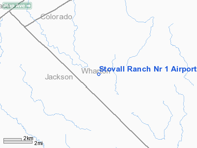
Stovall Ranch Nr 1 Airport |
Location & QuickFacts
| FAA Information Effective: | 2008-09-25 |
| Airport Identifier: | 7TE6 |
| Airport Status: | Operational |
| Longitude/Latitude: | 096-33-15.8980W/29-12-00.9080N
-96.554416/29.200252 (Estimated) |
| Elevation: | 108 ft / 32.92 m (Estimated) |
| Land: | 0 acres |
| From nearest city: | 15 nautical miles W of El Campo, TX |
| Location: | Wharton County, TX |
| Magnetic Variation: | 06E (1985) |
Owner & Manager
| Ownership: | Privately owned |
| Owner: | Guy F Stovall Jr |
| Address: | Box 906
El Campo, TX 77437 |
| Phone number: | 409-543-3812 |
| Manager: | Guy F Stovall Jr |
| Address: | Box 906
El Campo, TX 77437 |
| Phone number: | 409-543-3812 |
Airport Operations and Facilities
| Airport Use: | Private |
| Wind indicator: | Yes |
| Segmented Circle: | No |
| Control Tower: | No |
| Landing fee charge: | No |
| Sectional chart: | Houston |
| Region: | ASW - Southwest |
| Boundary ARTCC: | ZHU - Houston |
| Tie-in FSS: | CXO - Montgomery County |
| FSS on Airport: | No |
| FSS Toll Free: | 1-800-WX-BRIEF
FOR FP FILING CALL CXO FSS 1-800-833-5602. |
Airport Services
| Airframe Repair: | NONE |
| Power Plant Repair: | NONE |
Runway Information
Runway 17/35
| Dimension: | 3300 x 60 ft / 1005.8 x 18.3 m |
| Surface: | ASPH, |
| |
Runway 17 |
Runway 35 |
| Traffic Pattern: | Left | Left |
| Markings: | Nonstandard,
17/35 IS MKD WITH YELLOW BROKEN LINE IN MIDDLE OF WHITE ASPHALT. | , |
|
Radio Navigation Aids
| ID |
Type |
Name |
Ch |
Freq |
Var |
Dist |
| ARM | NDB | Wharton | | 245.00 | 06E | 21.4 nm |
| OKT | NDB | Yoakum | | 350.00 | 06E | 31.4 nm |
| PKV | NDB | Port Lavaca | | 515.00 | 05E | 33.7 nm |
| BYY | NDB | Bay City | | 344.00 | 06E | 39.0 nm |
| VCT | VOR/DME | Victoria | 027X | 109.00 | 06E | 28.7 nm |
| ELA | VOR/DME | Eagle Lake | 111X | 116.40 | 08E | 30.4 nm |
| PSX | VORTAC | Palacios | 120X | 117.30 | 08E | 29.3 nm |
| IDU | VORTAC | Industry | 039X | 110.20 | 08E | 45.4 nm |
Remarks
- ARPT ESTAB PRIOR TO 1959.
Images and information placed above are from
http://www.airport-data.com/airport/7TE6/
We thank them for the data!
| General Info
|
| Country |
United States
|
| State |
TEXAS
|
| FAA ID |
7TE6
|
| Latitude |
29-12-00.908N
|
| Longitude |
096-33-15.898W
|
| Elevation |
108 feet
|
| Near City |
EL CAMPO
|
We don't guarantee the information is fresh and accurate. The data may
be wrong or outdated.
For more up-to-date information please refer to other sources.
|
|


