 |
|
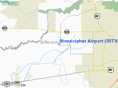
Location & QuickFacts
| FAA Information Effective: | 2008-09-25 |
| Airport Identifier: | 55TX |
| Airport Status: | Operational |
| Longitude/Latitude: | 094-15-22.6670W/30-06-43.7660N
-94.256296/30.112157 (Estimated) |
| Elevation: | 39 ft / 11.89 m (Estimated) |
| Land: | 0 acres |
| From nearest city: | 7 nautical miles W of Beaumont, TX |
| Location: | Jefferson County, TX |
| Magnetic Variation: | 05E (1985) |
Owner & Manager
| Ownership: | Privately owned |
| Owner: | Guy A Stonecipher Jr. |
| Address: | Route 7, Box 145 (moore Rd)
Beaumont, TX 77706 |
| Phone number: | 409-753-2657 |
| Manager: | Guy Stonecipher, Jr |
| Address: | Route 7, Box 145 (moore Rd)
Beaumont, TX 77706 |
| Phone number: | 409-753-2657 |
Airport Operations and Facilities
| Airport Use: | Private |
| Wind indicator: | Yes |
| Segmented Circle: | No |
| Control Tower: | No |
| Landing fee charge: | No |
| Sectional chart: | Houston |
| Region: | ASW - Southwest |
| Boundary ARTCC: | ZHU - Houston |
| Tie-in FSS: | CXO - Montgomery County |
| FSS on Airport: | No |
| FSS Toll Free: | 1-800-WX-BRIEF |
Airport Services
| Airframe Repair: | NONE |
| Power Plant Repair: | NONE |
Runway Information
Runway 17/35
| Dimension: | 2200 x 30 ft / 670.6 x 9.1 m |
| Surface: | TURF, |
| |
Runway 17 |
Runway 35 |
| Traffic Pattern: | Right | Right |
| Obstruction: | | 35 ft plines |
|
Radio Navigation Aids
| ID |
Type |
Name |
Ch |
Freq |
Var |
Dist |
| GDE | NDB | Goodhue | | 368.00 | 07E | 3.8 nm |
| HRD | NDB | Hardin County | | 524.00 | 04E | 13.5 nm |
| ORG | NDB | Orange | | 211.00 | 05E | 24.1 nm |
| CBC | NDB | Anahuac | | 413.00 | 05E | 29.4 nm |
| UX | NDB | Sulfy | | 278.00 | 04E | 43.7 nm |
| DQU | NDB | De Quincy | | 410.00 | 05E | 45.4 nm |
| BPT | VOR/DME | Beaumont | 092X | 114.50 | 07E | 16.0 nm |
| SBI | VOR/DME | Sabine Pass | 101X | 115.40 | 07E | 28.0 nm |
| MHF | VOR/DME | Trinity | 083X | 113.60 | 07E | 42.6 nm |
| DAS | VORTAC | Daisetta | 116X | 116.90 | 05E | 20.7 nm |
Images and information placed above are from
http://www.airport-data.com/airport/55TX/
We thank them for the data!
| General Info
|
| Country |
United States
|
| State |
TEXAS
|
| FAA ID |
55TX
|
| Latitude |
30-06-43.766N
|
| Longitude |
094-15-22.667W
|
| Elevation |
39 feet
|
| Near City |
BEAUMONT
|
We don't guarantee the information is fresh and accurate. The data may
be wrong or outdated.
For more up-to-date information please refer to other sources.
|
|


