 |
|
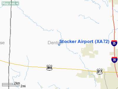
Location & QuickFacts
| FAA Information Effective: | 2008-09-25 |
| Airport Identifier: | XA72 |
| Airport Status: | Operational |
| Longitude/Latitude: | 097-17-22.0000W/33-16-37.0000N
-97.289444/33.276944 (Estimated) |
| Elevation: | 770 ft / 234.70 m (Estimated) |
| Land: | 0 acres |
| From nearest city: | 3 nautical miles W of Krum, TX |
| Location: | Denton County, TX |
| Magnetic Variation: | () |
Owner & Manager
| Ownership: | Privately owned |
| Owner: | Earnest Stocker |
| Address: | 9223 S. Hickory Rd
Krum, TX 76249 |
| Phone number: | 940-482-3411 |
| Manager: | Earnest Stocker |
| Address: | 9223 S. Hickory Rd
Krum, TX 76249 |
| Phone number: | 940-368-0140 |
Airport Operations and Facilities
| Airport Use: | Private |
| Wind indicator: | Yes |
| Control Tower: | No |
| Sectional chart: | Dallas-ft Worth |
| Region: | ASW - Southwest |
| Boundary ARTCC: | ZFW - Fort Worth |
| Tie-in FSS: | FTW - Fort Worth |
| FSS Phone: | 817-541-3474 |
| FSS Toll Free: | 1-800-WX-BRIEF |
Runway Information
Runway 08/26
| Dimension: | 2400 x 30 ft / 731.5 x 9.1 m |
| Surface: | TURF, |
| |
Runway 08 |
Runway 26 |
| Traffic Pattern: | Left | Right |
| Obstruction: | | 40 ft pline, 500.0 ft from runway |
|
Runway 17/35
| Dimension: | 1900 x 30 ft / 579.1 x 9.1 m |
| Surface: | TURF, |
| |
Runway 17 |
Runway 35 |
| Traffic Pattern: | Left | Left |
| Obstruction: | 40 ft pline, 500.0 ft from runway | 262 ft tower, 2500.0 ft from runway |
|
Radio Navigation Aids
| ID |
Type |
Name |
Ch |
Freq |
Var |
Dist |
| GLE | NDB | Gainesville | | 330.00 | 06E | 26.9 nm |
| GMZ | NDB | Grindstone Mountain | | 356.00 | 07E | 31.3 nm |
| RBD | NDB | Redbird | | 287.00 | 06E | 41.8 nm |
| XQH | NDB | Cedar Hill | | 353.00 | 08E | 44.1 nm |
| DNI | NDB | Denison | | 341.00 | 06E | 45.2 nm |
| PQF | NDB | Mesquite | | 248.00 | 06E | 47.5 nm |
| MWL | NDB | Mineral Wells | | 266.00 | 06E | 48.7 nm |
| NFW | TACAN | Nas Jrb Fort Worth | 024X | | 07E | 31.3 nm |
| TTT | VOR/DME | Maverick | 078X | 113.10 | 06E | 27.5 nm |
| CVE | VOR/DME | Cowboy | 109X | 116.20 | 06E | 30.3 nm |
| FUZ | VORTAC | Ranger | 104X | 115.70 | 06E | 23.9 nm |
| UKW | VORTAC | Bowie | 071X | 112.40 | 06E | 30.9 nm |
| MQP | VORTAC | Millsap | 124X | 117.70 | 09E | 48.7 nm |
| FTW | VOT | Fort Worth Meacham | | 108.20 | | 27.8 nm |
| DAL | VOT | Dallas Love Field | | 113.30 | | 34.0 nm |
Remarks
- PRVDD RY 17/35 TFC PATTERNS LIMITED TO EAST SIDE OF RY AND RY 08/26 TFC PATTERNS LIMITED TO NORTH SIDE OF RY.
Images and information placed above are from
http://www.airport-data.com/airport/XA72/
We thank them for the data!
|
|


