 |
|
Location & QuickFacts
| FAA Information Effective: | 2008-09-25 |
| Airport Identifier: | TS13 |
| Airport Status: | Operational |
| Longitude/Latitude: | 096-18-31.8740W/29-17-40.8940N
-96.308854/29.294693 (Estimated) |
| Elevation: | 115 ft / 35.05 m (Estimated) |
| Land: | 0 acres |
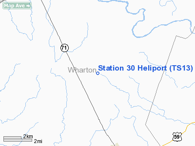
| From nearest city: | 5 nautical miles NE of El Campo, TX |
| Location: | Wharton County, TX |
| Magnetic Variation: | 06E (1985) |
Owner & Manager
| Ownership: | Privately owned |
| Owner: | Transco Energy Company |
| Address: | Rt 1 Box 174-a
El Campo, TX 77437 |
| Phone number: | 409-543-3345 |
| Manager: | R. Barry |
| Address: | Rt 1, Box 174-a
El Campo, TX 77437 |
| Phone number: | 409-543-3345 |
Airport Operations and Facilities
| Airport Use: | Private |
| Segmented Circle: | No |
| Control Tower: | No |
| Sectional chart: | Houston |
| Region: | ASW - Southwest |
| Boundary ARTCC: | ZHU - Houston |
| Tie-in FSS: | CXO - Montgomery County |
| FSS Toll Free: | 1-800-WX-BRIEF
FOR FP FILING CALL CXO FSS 1-800-833-5602. |
Runway Information
Helipad H1
| Dimension: | 30 x 25 ft / 9.1 x 7.6 m |
| Surface: | CONC, |
| |
Runway H1 |
Runway |
| Traffic Pattern: | Left | Left |
|
Radio Navigation Aids
| ID |
Type |
Name |
Ch |
Freq |
Var |
Dist |
| ARM | NDB | Wharton | | 245.00 | 06E | 8.6 nm |
| BYY | NDB | Bay City | | 344.00 | 06E | 30.5 nm |
| SGR | NDB | Hull | | 388.00 | 05E | 39.7 nm |
| PKV | NDB | Port Lavaca | | 515.00 | 05E | 43.4 nm |
| OKT | NDB | Yoakum | | 350.00 | 06E | 43.5 nm |
| LYD | NDB | Lakeside | | 249.00 | 05E | 45.5 nm |
| SYG | NDB | Sandy Point | | 402.00 | 05E | 45.7 nm |
| ELA | VOR/DME | Eagle Lake | 111X | 116.40 | 08E | 22.1 nm |
| VCT | VOR/DME | Victoria | 027X | 109.00 | 06E | 42.4 nm |
| PSX | VORTAC | Palacios | 120X | 117.30 | 08E | 31.9 nm |
| IDU | VORTAC | Industry | 039X | 110.20 | 08E | 41.9 nm |
Images and information placed above are from
http://www.airport-data.com/airport/TS13/
We thank them for the data!
| General Info
|
| Country |
United States
|
| State |
TEXAS
|
| FAA ID |
TS13
|
| Latitude |
29-17-40.894N
|
| Longitude |
096-18-31.874W
|
| Elevation |
115 feet
|
| Near City |
EL CAMPO
|
We don't guarantee the information is fresh and accurate. The data may
be wrong or outdated.
For more up-to-date information please refer to other sources.
|
|


