 |
|
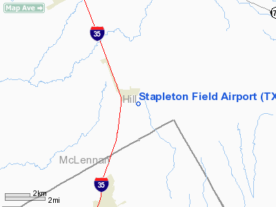
Location & QuickFacts
| FAA Information Effective: | 2008-09-25 |
| Airport Identifier: | TX03 |
| Airport Status: | Operational |
| Longitude/Latitude: | 097-04-01.0080W/31-52-30.5720N
-97.066947/31.875159 (Estimated) |
| Elevation: | 716 ft / 218.24 m (Estimated) |
| Land: | 0 acres |
| From nearest city: | 1 nautical miles S of Abbott, TX |
| Location: | Hill County, TX |
| Magnetic Variation: | 07E (1985) |
Owner & Manager
| Ownership: | Privately owned |
| Owner: | Norman F Stapleton |
| Address: | Rt 2/box 54
Abbott, TX 76621 |
| Phone number: | 817-582-9708 |
| Manager: | Norman F Stapleton |
| Address: | Rt 2/box 54
Abbott, TX 76621 |
| Phone number: | 817-582-9708 |
Airport Operations and Facilities
| Airport Use: | Private |
| Wind indicator: | Yes |
| Segmented Circle: | No |
| Control Tower: | No |
| Sectional chart: | San Antonio |
| Region: | ASW - Southwest |
| Boundary ARTCC: | ZFW - Fort Worth |
| Tie-in FSS: | FTW - Fort Worth |
| FSS Phone: | 817-541-3474 |
| FSS Toll Free: | 1-800-WX-BRIEF |
Runway Information
Runway E/W
| Dimension: | 1745 x 50 ft / 531.9 x 15.2 m |
| Surface: | TURF, |
| |
Runway E |
Runway W |
| Traffic Pattern: | Left | Left |
| Obstruction: | 4 ft fence | , 200.0 ft from runway |
|
Runway N/S
| Dimension: | 2360 x 150 ft / 719.3 x 45.7 m |
| Surface: | TURF, |
| |
Runway N |
Runway S |
| Traffic Pattern: | Left | Left |
| Obstruction: | 4 ft fence | 4 ft fence |
|
Radio Navigation Aids
| ID |
Type |
Name |
Ch |
Freq |
Var |
Dist |
| ROB | NDB | Robinson | | 400.00 | 07E | 22.3 nm |
| LXY | NDB | Mexia | | 329.00 | 07E | 31.7 nm |
| CGQ | NDB | Powell | | 344.00 | 06E | 34.5 nm |
| CRS | NDB | Corsicana | | 396.00 | 06E | 35.5 nm |
| XQH | NDB | Cedar Hill | | 353.00 | 08E | 43.3 nm |
| PYF | NDB | Pyramid | | 418.00 | 06E | 44.4 nm |
| LNC | NDB | Lancaster | | 239.00 | 06E | 45.7 nm |
| RBD | NDB | Redbird | | 287.00 | 06E | 49.2 nm |
| GNL | VOR/DME | Groesbeck | 025X | 108.80 | 05E | 31.8 nm |
| TPL | VOR/DME | Temple | 041X | 110.40 | 09E | 44.0 nm |
| ACT | VORTAC | Waco | 100X | 115.30 | 09E | 16.4 nm |
| JEN | VORTAC | Glen Rose | 097X | 115.00 | 06E | 44.7 nm |
| CQY | VORTAC | Cedar Creek | 095X | 114.80 | 06E | 47.1 nm |
Remarks
- PRVDD LANDING THRS ARE LCTD TO PRVD A CLEAR 20:1 APCH SLOPE OVER ANY OBJECTS IN THE APCH AREAS.
Images and information placed above are from
http://www.airport-data.com/airport/TX03/
We thank them for the data!
| General Info
|
| Country |
United States
|
| State |
TEXAS
|
| FAA ID |
TX03
|
| Latitude |
31-52-30.572N
|
| Longitude |
097-04-01.008W
|
| Elevation |
716 feet
|
| Near City |
ABBOTT
|
We don't guarantee the information is fresh and accurate. The data may
be wrong or outdated.
For more up-to-date information please refer to other sources.
|
|


