 |
|
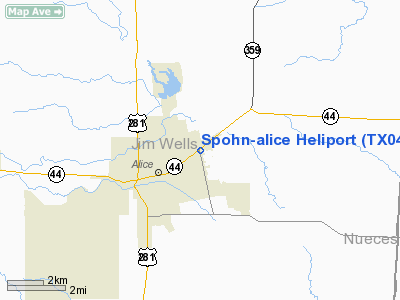
Location & QuickFacts
| FAA Information Effective: | 2008-09-25 |
| Airport Identifier: | TX04 |
| Airport Status: | Operational |
| Longitude/Latitude: | 098-02-51.0000W/27-45-43.0000N
-98.047500/27.761944 (Estimated) |
| Elevation: | 185 ft / 56.39 m (Estimated) |
| Land: | 0 acres |
| From nearest city: | 1 nautical miles W of Alice, TX |
| Location: | Jim Wells County, TX |
| Magnetic Variation: | 06E (2000) |
Owner & Manager
| Ownership: | Privately owned |
| Owner: | Spohn Health System |
| Address: | 700 North Airport Road Fm 1931
Alice, TX 78332 |
| Phone number: | 361-661-8000 |
| Manager: | Dominic Dominguez
ADMINISTRATOR. |
| Address: | 700 North Airport Road Fm 1931
Alice, TX 78332 |
| Phone number: | 361-661-8000 |
Airport Operations and Facilities
| Airport Use: | Private
MEDICAL. |
| Wind indicator: | Yes |
| Segmented Circle: | Yes |
| Control Tower: | No |
| Lighting Schedule: | DUSK-DAWN |
| Sectional chart: | Brownsville |
| Region: | ASW - Southwest |
| Boundary ARTCC: | ZHU - Houston |
| Tie-in FSS: | SJT - San Angelo |
| FSS Toll Free: | 1-800-WX-BRIEF |
Runway Information
Helipad H1
| Dimension: | 15 x 15 ft / 4.6 x 4.6 m |
| Surface: | ASPH, |
| |
Runway H1 |
Runway |
| Traffic Pattern: | Left | Left |
|
Radio Navigation Aids
| ID |
Type |
Name |
Ch |
Freq |
Var |
Dist |
| TKB | NDB | Kleberg County | | 347.00 | 06E | 9.6 nm |
| BKS | NDB | Brooks County | | 353.00 | 06E | 33.6 nm |
| BEA | NDB | Beeville | | 284.00 | 07E | 38.8 nm |
| HBV | NDB | Hebbronville | | 266.00 | 06E | 44.5 nm |
| NOG | TACAN | Orange Grove | 063X | | 09E | 8.0 nm |
| NQI | TACAN | Kingsville | 125X | | 09E | 20.4 nm |
| ALI | VOR | Alice | | 114.50 | 06E | 1.9 nm |
| CRP | VORTAC | Corpus Christi | 102X | 115.50 | 09E | 33.1 nm |
| NGP | VORTAC | Truax | 087X | 114.00 | 06E | 40.3 nm |
| THX | VORTAC | Three Rivers | 051X | 111.40 | 08E | 45.0 nm |
Remarks
- PRVDD TREES NORTH OF HELIPORT REMOVED.
Images and information placed above are from
http://www.airport-data.com/airport/TX04/
We thank them for the data!
| General Info
|
| Country |
United States
|
| State |
TEXAS
|
| FAA ID |
TX04
|
| Latitude |
27-45-43.000N
|
| Longitude |
098-02-51.000W
|
| Elevation |
185 feet
|
| Near City |
ALICE
|
We don't guarantee the information is fresh and accurate. The data may
be wrong or outdated.
For more up-to-date information please refer to other sources.
|
|


