 |
|
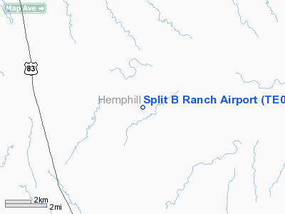
Location & QuickFacts
| FAA Information Effective: | 2008-09-25 |
| Airport Identifier: | TE04 |
| Airport Status: | Operational |
| Longitude/Latitude: | 100-17-06.0000W/35-42-09.0000N
-100.285000/35.702500 (Estimated) |
| Elevation: | 2580 ft / 786.38 m (Estimated) |
| Land: | 10 acres |
| From nearest city: | 13 nautical miles NW of Canadian, TX |
| Location: | Hemphill County, TX |
| Magnetic Variation: | 07E (2000) |
Owner & Manager
| Ownership: | Privately owned |
| Owner: | Natalie & Wp Buckthal |
| Address: | 700 S Fillmore Suite 444
Amarillo, TX 79101 |
| Phone number: | 806-373-0829 |
| Manager: | Natalie & Wp Buckthal |
| Address: | 700 S Fillmore Suite 444
Amarillo, TX 79101 |
| Phone number: | 806-373-0829 |
Airport Operations and Facilities
| Airport Use: | Private |
| Wind indicator: | Yes |
| Segmented Circle: | No |
| Control Tower: | No |
| Sectional chart: | Dallas-ft Worth |
| Region: | ASW - Southwest |
| Boundary ARTCC: | ZAB - Albuquerque |
| Tie-in FSS: | FTW - Fort Worth |
| FSS Phone: | 817-541-3474 |
| FSS Toll Free: | 1-800-WX-BRIEF |
Runway Information
Runway 18/36
| Dimension: | 3000 x 100 ft / 914.4 x 30.5 m |
| Surface: | TURF, |
| |
Runway 18 |
Runway 36 |
| Traffic Pattern: | Left | Left |
|
Radio Navigation Aids
| ID |
Type |
Name |
Ch |
Freq |
Var |
Dist |
| HHF | NDB | Hemphill County | | 400.00 | 08E | 12.8 nm |
| PPA | NDB | Pampa | | 368.00 | 09E | 34.9 nm |
| EZY | NDB | Elk City | | 241.00 | 08E | 46.4 nm |
| PYX | NDB | Perryton | | 266.00 | 09E | 48.2 nm |
| SYO | VORTAC | Sayre | 099X | 115.20 | 10E | 38.4 nm |
| GAG | VORTAC | Gage | 103X | 115.60 | 10E | 43.3 nm |
Images and information placed above are from
http://www.airport-data.com/airport/TE04/
We thank them for the data!
|
|


