 |
|
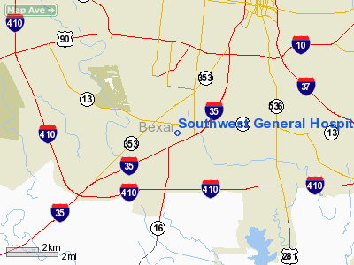
Southwest General Hospital Heliport |
Location & QuickFacts
| FAA Information Effective: | 2008-09-25 |
| Airport Identifier: | TX69 |
| Airport Status: | Operational |
| Longitude/Latitude: | 098-32-42.0600W/29-21-06.8500N
-98.545017/29.351903 (Estimated) |
| Elevation: | 657 ft / 200.25 m (Estimated) |
| Land: | 0 acres |
| From nearest city: | 5 nautical miles SS of San Antonio, TX |
| Location: | Bexar County, TX |
| Magnetic Variation: | () |
Owner & Manager
| Ownership: | Privately owned |
| Owner: | Southwest General Hospital |
| Address: | 7400 Barlite Blvd
San Antonio, TX 78224 |
| Phone number: | 210-921-3536 |
| Address: |
|
Airport Operations and Facilities
| Airport Use: | Private |
| Wind indicator: | Yes |
| Control Tower: | No |
| Sectional chart: | San Antonio |
| Region: | ASW - Southwest |
| Boundary ARTCC: | ZHU - Houston |
| Tie-in FSS: | SJT - San Angelo |
| FSS Toll Free: | 1-800-WX-BRIEF |
Runway Information
Helipad H1
| Dimension: | 50 x 50 ft / 15.2 x 15.2 m |
| Surface: | CONC, |
| |
Runway H1 |
Runway |
| Traffic Pattern: | Left | Left |
|
Radio Navigation Aids
| ID |
Type |
Name |
Ch |
Freq |
Var |
Dist |
| CVB | NDB | Castroville | | 338.00 | 08E | 15.9 nm |
| PEZ | NDB | Pleasanton | | 275.00 | 07E | 23.9 nm |
| HHH | NDB | Devine | | 359.00 | 07E | 24.3 nm |
| HMA | NDB | Hondo | | 329.00 | 08E | 32.9 nm |
| ER | NDB | Shein | | 263.00 | 08E | 41.6 nm |
| KSY | TACAN | Kelly | 057X | | 07E | 3.0 nm |
| DHK | TACAN | Randolph | 036X | | 09E | 18.3 nm |
| SSF | VOR | Stinson | | 108.40 | 09E | 7.7 nm |
| HDO | VOR/DME | Hondo | 31X | 109.40 | 08E | 33.2 nm |
| RND | VORTAC | Randolph | 70X | 112.30 | 09E | 16.9 nm |
| SAT | VORTAC | San Antonio | 115X | 116.80 | 08E | 18.1 nm |
| CSI | VORTAC | Center Point | 122X | 117.50 | 08E | 49.0 nm |
| SAT | VOT | San Antonio Intl | | 110.40 | | 11.6 nm |
Images and information placed above are from
http://www.airport-data.com/airport/TX69/
We thank them for the data!
| General Info
|
| Country |
United States
|
| State |
TEXAS
|
| FAA ID |
TX69
|
| Latitude |
29-43-09.170N
|
| Longitude |
095-24-09.210W
|
| Elevation |
150 feet
|
| Near City |
HOUSTON
|
We don't guarantee the information is fresh and accurate. The data may
be wrong or outdated.
For more up-to-date information please refer to other sources.
|
|


