 |
|
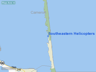
Southeastern Helicopters Heliport |
Location & QuickFacts
| FAA Information Effective: | 2008-09-25 |
| Airport Identifier: | 0XS5 |
| Airport Status: | Operational |
| Longitude/Latitude: | 097-10-25.8990W/26-08-49.2760N
-97.173861/26.147021 (Estimated) |
| Elevation: | 5 ft / 1.52 m (Estimated) |
| Land: | 0 acres |
| From nearest city: | 1 nautical miles N of South Padre Island, TX |
| Location: | Cameron County, TX |
| Magnetic Variation: | 07E (1985) |
Owner & Manager
| Ownership: | Privately owned |
| Owner: | Thomas W Whitehead |
| Address: | Rt 3 Box 27
Los Fresnos, TX |
| Manager: | Thomas W Whitehead |
| Address: | Rt 3 Box 27
Los Fresnos, TX |
| Phone number: | 512-943-5350 |
Airport Operations and Facilities
| Airport Use: | Private |
| Wind indicator: | Yes |
| Segmented Circle: | No |
| Control Tower: | No |
| Landing fee charge: | No |
| Sectional chart: | Brownsville |
| Region: | ASW - Southwest |
| Boundary ARTCC: | ZHU - Houston |
| Tie-in FSS: | SJT - San Angelo |
| FSS on Airport: | No |
| FSS Toll Free: | 1-800-WX-BRIEF |
Runway Information
Helipad H1
| Dimension: | 26 x 26 ft / 7.9 x 7.9 m |
| Surface: | CONC, |
| |
Runway H1 |
Runway |
| Traffic Pattern: | Left | Left |
|
Radio Navigation Aids
| ID |
Type |
Name |
Ch |
Freq |
Var |
Dist |
| HRL | VOR/DME | Harlingen | 029X | 109.20 | 05E | 26.3 nm |
| MAM | VOR/DME | Matamoros | 090X | 114.30 | 07E | 29.5 nm |
| BRO | VORTAC | Brownsville | 110X | 116.30 | 09E | 17.3 nm |
Remarks
- VFR OPNS ONLY; LIMIT EGRESS & INGRESS TO THE N/S/W ONLY.
Images and information placed above are from
http://www.airport-data.com/airport/0XS5/
We thank them for the data!
| General Info
|
| Country |
United States
|
| State |
TEXAS
|
| FAA ID |
0XS5
|
| Latitude |
26-08-49.276N
|
| Longitude |
097-10-25.899W
|
| Elevation |
5 feet
|
| Near City |
SOUTH PADRE ISLAND
|
We don't guarantee the information is fresh and accurate. The data may
be wrong or outdated.
For more up-to-date information please refer to other sources.
|
|


