 |
|
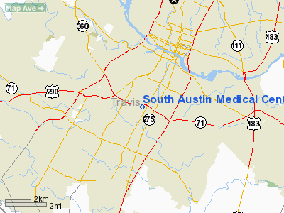
South Austin Medical Center Heliport |
Location & QuickFacts
| FAA Information Effective: | 2008-09-25 |
| Airport Identifier: | 22TX |
| Airport Status: | Operational |
| Longitude/Latitude: | 097-46-26.0000W/30-13-32.0000N
-97.773889/30.225556 (Estimated) |
| Elevation: | 687 ft / 209.40 m (Estimated) |
| Land: | 0 acres |
| From nearest city: | 0 nautical miles N of Austin, TX |
| Location: | Travis County, TX |
| Magnetic Variation: | () |
Owner & Manager
| Ownership: | Privately owned |
| Owner: | South Austin Hospital |
| Address: | 901 W. Ben White Blvd
Austin, TX 78704 |
| Phone number: | 512-448-7190 |
| Manager: | Bill Johnson |
| Address: | 901 W. Ben White Blvd
Austin, TX 78704 |
| Phone number: | 512-448-7190 |
Airport Operations and Facilities
| Airport Use: | Private |
| Wind indicator: | Yes |
| Control Tower: | No |
| Lighting Schedule: | RDO CTL
ACTIVATE: PERIMETER LGTS H1 - 123.05. |
| Sectional chart: | San Antonio |
| Region: | ASW - Southwest |
| Boundary ARTCC: | ZHU - Houston |
| Tie-in FSS: | SJT - San Angelo |
| FSS Toll Free: | 1-800-WX-BRIEF |
Runway Information
Helipad H1
| Dimension: | 40 x 40 ft / 12.2 x 12.2 m |
| Surface: | CONC, |
| |
Runway H1 |
Runway |
| Traffic Pattern: | Left | Left |
|
Radio Navigation Aids
| ID |
Type |
Name |
Ch |
Freq |
Var |
Dist |
| GUO | NDB | Georgetown | | 332.00 | 06E | 28.0 nm |
| MFS | NDB | Horseshoe Bay Resort | | 403.00 | 07E | 35.2 nm |
| BMQ | NDB | Burnet | | 341.00 | 07E | 39.1 nm |
| GYB | NDB | Lee County | | 385.00 | 07E | 41.4 nm |
| IL | NDB | Iresh | | 278.00 | 07E | 48.1 nm |
| DHK | TACAN | Randolph | 036X | | 09E | 48.7 nm |
| GRK | VOR/DME | Gray | 055X | 111.80 | 07E | 48.6 nm |
| CWK | VORTAC | Centex | 075X | 112.80 | 06E | 15.7 nm |
| STV | VORTAC | Stonewall | 085X | 113.80 | 08E | 48.4 nm |
Remarks
- 385 FT PLINE 385 FT WEST.
- PRVDD CONTACT AUSTIN ATCT PRIOR TO START OF OPERATIONS AND LOCATE THE PAD 30 FT WEST OF PROPOSED SITE.
Images and information placed above are from
http://www.airport-data.com/airport/22TX/
We thank them for the data!
| General Info
|
| Country |
United States
|
| State |
TEXAS
|
| FAA ID |
22TX
|
| Latitude |
33-28-00.436N
|
| Longitude |
094-19-00.713W
|
| Elevation |
300 feet
|
| Near City |
TEXARKANA
|
We don't guarantee the information is fresh and accurate. The data may
be wrong or outdated.
For more up-to-date information please refer to other sources.
|
|


