 |
|
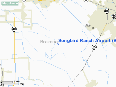
Location & QuickFacts
| FAA Information Effective: | 2008-09-25 |
| Airport Identifier: | 91TS |
| Airport Status: | Operational |
| Longitude/Latitude: | 095-20-26.0000W/29-22-02.6700N
-95.340556/29.367408 (Estimated) |
| Elevation: | 34 ft / 10.36 m (Estimated) |
| Land: | 70 acres |
| From nearest city: | 6 nautical miles E of Rosharon, TX |
| Location: | Brazoria County, TX |
| Magnetic Variation: | 06E (1985) |
Owner & Manager
| Ownership: | Privately owned |
| Owner: | Songbird Ranch Inc |
| Address: | 16 Songbird Drive
Rosharon, TX 77583 |
| Phone number: | 281-331-0195 |
| Manager: | Rick Carr |
| Address: | 16 Songbird Drive
Rosharon, TX 77583 |
| Phone number: | 281-331-0195 |
Airport Operations and Facilities
| Airport Use: | Private |
| Wind indicator: | Yes |
| Segmented Circle: | No |
| Control Tower: | No |
| Sectional chart: | Houston |
| Region: | ASW - Southwest |
| Boundary ARTCC: | ZHU - Houston |
| Tie-in FSS: | CXO - Montgomery County |
| FSS Toll Free: | 1-800-WX-BRIEF |
Runway Information
Runway 15/33
| Dimension: | 3200 x 30 ft / 975.4 x 9.1 m |
| Surface: | CONC, |
| |
Runway 15 |
Runway 33 |
| Traffic Pattern: | Left | Right |
| Obstruction: | 50 ft trees, 300.0 ft from runway | 40 ft pline, 150.0 ft from runway |
|
Radio Navigation Aids
| ID |
Type |
Name |
Ch |
Freq |
Var |
Dist |
| SYG | NDB | Sandy Point | | 402.00 | 05E | 10.5 nm |
| SGR | NDB | Hull | | 388.00 | 05E | 22.9 nm |
| JPA | NDB | Sanjac | | 347.00 | 05E | 23.0 nm |
| GLS | NDB | Galveston | | 206.00 | 08E | 30.7 nm |
| LYD | NDB | Lakeside | | 249.00 | 05E | 32.2 nm |
| BYY | NDB | Bay City | | 344.00 | 06E | 36.1 nm |
| EYQ | NDB | Weiser | | 286.00 | 06E | 37.5 nm |
| BVP | NDB | Nixin | | 326.00 | 05E | 38.2 nm |
| CBC | NDB | Anahuac | | 413.00 | 05E | 43.0 nm |
| ARM | NDB | Wharton | | 245.00 | 06E | 43.1 nm |
| DWH | NDB | David Hooks | | 521.00 | 05E | 47.1 nm |
| EFD | TACAN | Ellington | 031X | | 05E | 17.2 nm |
| HUB | VOR/DME | Hobby | 118X | 117.10 | 05E | 17.6 nm |
| MHF | VOR/DME | Trinity | 083X | 113.60 | 07E | 32.8 nm |
| VUH | VORTAC | Scholes | 077X | 113.00 | 06E | 25.5 nm |
| IAH | VORTAC | Humble | 113X | 116.60 | 05E | 35.4 nm |
| HOU | VOT | Houston Wm P Hobby | | 108.40 | | 17.0 nm |
Remarks
- PRVDD THRESHOLDS ARE DISPLACED TO PROVIDE 20:1 CLEARANCE OVER OBSTRUCTIONS.
Images and information placed above are from
http://www.airport-data.com/airport/91TS/
We thank them for the data!
| General Info
|
| Country |
United States
|
| State |
TEXAS
|
| FAA ID |
91TS
|
| Latitude |
29-22-06.857N
|
| Longitude |
095-20-23.773W
|
| Elevation |
34 feet
|
| Near City |
ROSHARON
|
We don't guarantee the information is fresh and accurate. The data may
be wrong or outdated.
For more up-to-date information please refer to other sources.
|
|


