 |
|
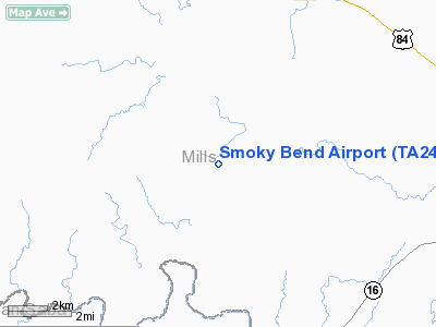
Location & QuickFacts
| FAA Information Effective: | 2008-09-25 |
| Airport Identifier: | TA24 |
| Airport Status: | Operational |
| Longitude/Latitude: | 098-42-41.1670W/31-28-30.5920N
-98.711435/31.475164 (Estimated) |
| Elevation: | 1320 ft / 402.34 m (Estimated) |
| Land: | 0 acres |
| From nearest city: | 5 nautical miles SW of Mullin, TX |
| Location: | Mills County, TX |
| Magnetic Variation: | 07E (1985) |
Owner & Manager
| Ownership: | Privately owned |
| Owner: | J C Walter Jr |
| Address: | 1021 Main St Ste 2200
Houston, TX 77002-6605 |
| Phone number: | 713-756-1190 |
| Manager: | Joe Walter Jr. |
| Address: | P.o. Box 36
Mullin, TX 76864 |
| Phone number: | 915-986-3922 |
Airport Operations and Facilities
| Airport Use: | Private |
| Wind indicator: | No |
| Segmented Circle: | No |
| Control Tower: | No |
| Landing fee charge: | No |
| Sectional chart: | San Antonio |
| Region: | ASW - Southwest |
| Boundary ARTCC: | ZFW - Fort Worth |
| Tie-in FSS: | SJT - San Angelo |
| FSS on Airport: | No |
| FSS Toll Free: | 1-800-WX-BRIEF |
Runway Information
Runway 16/34
| Dimension: | 4000 x 50 ft / 1219.2 x 15.2 m |
| Surface: | ASPH, |
| |
Runway 16 |
Runway 34 |
| Traffic Pattern: | Left | Left |
|
Radio Navigation Aids
| ID |
Type |
Name |
Ch |
Freq |
Var |
Dist |
| MNZ | NDB | Hamilton | | 251.00 | 07E | 30.2 nm |
| BBD | NDB | Brady | | 380.00 | 07E | 36.1 nm |
| COM | NDB | Coleman | | 385.00 | 07E | 41.8 nm |
| GR | NDB | Starn | | 323.00 | 07E | 46.6 nm |
| BWD | VOR/DME | Brownwood | 023X | 108.60 | 08E | 28.1 nm |
| LZZ | VORTAC | Lampasas | 072X | 112.50 | 08E | 34.0 nm |
| LLO | VORTAC | Llano | 019X | 108.20 | 08E | 41.0 nm |
Remarks
Images and information placed above are from
http://www.airport-data.com/airport/TA24/
We thank them for the data!
| General Info
|
| Country |
United States
|
| State |
TEXAS
|
| FAA ID |
TA24
|
| Latitude |
31-28-30.592N
|
| Longitude |
098-42-41.167W
|
| Elevation |
1320 feet
|
| Near City |
MULLIN
|
We don't guarantee the information is fresh and accurate. The data may
be wrong or outdated.
For more up-to-date information please refer to other sources.
|
|


