 |
|
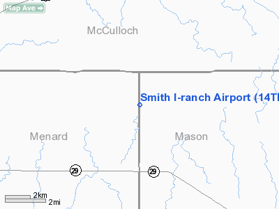
Location & QuickFacts
| FAA Information Effective: | 2008-09-25 |
| Airport Identifier: | 14TE |
| Airport Status: | Operational |
| Longitude/Latitude: | 099-29-01.2240W/30-55-00.6270N
-99.483673/30.916841 (Estimated) |
| Elevation: | 1793 ft / 546.51 m (Surveyed) |
| Land: | 0 acres |
| From nearest city: | 4 nautical miles NE of Hext, TX |
| Location: | Mason County, TX |
| Magnetic Variation: | 08E (1985) |
Owner & Manager
| Ownership: | Privately owned |
| Owner: | James H Smith |
| Address: | 712 Ridgemont
San Antonio, TX 78209 |
| Phone number: | 915-265-4254 |
| Manager: | James H. Smith |
| Address: | 712 Ridgemont
San Antonio, TX 78209 |
| Phone number: | 915-265-4254 |
Airport Operations and Facilities
| Airport Use: | Private |
| Wind indicator: | Yes |
| Segmented Circle: | No |
| Control Tower: | No |
| Landing fee charge: | No |
| Sectional chart: | San Antonio |
| Region: | ASW - Southwest |
| Boundary ARTCC: | ZHU - Houston |
| Tie-in FSS: | SJT - San Angelo |
| FSS on Airport: | No |
| FSS Toll Free: | 1-800-WX-BRIEF |
Airport Services
| Airframe Repair: | NONE |
| Power Plant Repair: | NONE |
Runway Information
Runway 12/30
| Dimension: | 2700 x 100 ft / 823.0 x 30.5 m |
| Surface: | TURF-DIRT, |
| |
Runway 12 |
Runway 30 |
| Traffic Pattern: | Left | Left |
|
Radio Navigation Aids
| ID |
Type |
Name |
Ch |
Freq |
Var |
Dist |
| BBD | NDB | Brady | | 380.00 | 07E | 17.8 nm |
| JCT | VORTAC | Junction | 107X | 116.00 | 08E | 25.8 nm |
| LLO | VORTAC | Llano | 019X | 108.20 | 08E | 36.7 nm |
Images and information placed above are from
http://www.airport-data.com/airport/14TE/
We thank them for the data!
| General Info
|
| Country |
United States
|
| State |
TEXAS
|
| FAA ID |
14TE
|
| Latitude |
30-55-00.627N
|
| Longitude |
099-29-01.224W
|
| Elevation |
1793 feet
|
| Near City |
HEXT
|
We don't guarantee the information is fresh and accurate. The data may
be wrong or outdated.
For more up-to-date information please refer to other sources.
|
|


