 |
|
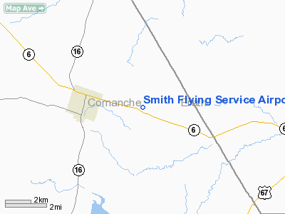
Smith Flying Service Airport |
Location & QuickFacts
| FAA Information Effective: | 2008-09-25 |
| Airport Identifier: | TS14 |
| Airport Status: | Operational |
| Longitude/Latitude: | 098-29-16.8000W/32-06-31.2000N
-98.488000/32.108667 (Estimated) |
| Elevation: | 1275 ft / 388.62 m (Estimated) |
| Land: | 12 acres |
| From nearest city: | 2 nautical miles E of De Leon, TX |
| Location: | Comanche County, TX |
| Magnetic Variation: | 07E (1995) |
Owner & Manager
| Ownership: | Privately owned |
| Owner: | Bill & Betty Smith |
| Address: | Po Box 97
De Leon, TX 76444 |
| Phone number: | 254-893-6335 |
| Manager: | Bill & Betty Smith |
| Address: | Po Box 97
De Leon, TX 76444 |
| Phone number: | 254-893-6335 |
Airport Operations and Facilities
| Airport Use: | Private |
| Wind indicator: | Yes |
| Segmented Circle: | No |
| Control Tower: | No |
| Sectional chart: | Dallas-ft Worth |
| Region: | ASW - Southwest |
| Boundary ARTCC: | ZFW - Fort Worth |
| Tie-in FSS: | FTW - Fort Worth |
| FSS Phone: | 817-541-3474 |
| FSS Toll Free: | 1-800-WX-BRIEF |
Airport Services
Runway Information
Runway 18/36
| Dimension: | 2350 x 25 ft / 716.3 x 7.6 m |
| Surface: | ASPH, |
| |
Runway 18 |
Runway 36 |
| Traffic Pattern: | Left | Left |
| Obstruction: | | 50 ft pline, 750.0 ft from runway |
|
Radio Navigation Aids
| ID |
Type |
Name |
Ch |
Freq |
Var |
Dist |
| OIP | NDB | Old Rip | | 410.00 | 07E | 23.9 nm |
| MNZ | NDB | Hamilton | | 251.00 | 07E | 34.1 nm |
| BKD | NDB | Breckenridge | | 245.00 | 07E | 43.5 nm |
| MWL | NDB | Mineral Wells | | 266.00 | 06E | 46.2 nm |
| COM | NDB | Coleman | | 385.00 | 07E | 49.5 nm |
| BWD | VOR/DME | Brownwood | 023X | 108.60 | 08E | 27.2 nm |
| JEN | VORTAC | Glen Rose | 097X | 115.00 | 06E | 31.2 nm |
| MQP | VORTAC | Millsap | 124X | 117.70 | 09E | 44.7 nm |
Images and information placed above are from
http://www.airport-data.com/airport/TS14/
We thank them for the data!
| General Info
|
| Country |
United States
|
| State |
TEXAS
|
| FAA ID |
TS14
|
| Latitude |
32-06-31.200N
|
| Longitude |
098-29-16.800W
|
| Elevation |
1275 feet
|
| Near City |
DE LEON
|
We don't guarantee the information is fresh and accurate. The data may
be wrong or outdated.
For more up-to-date information please refer to other sources.
|
|


