 |
|
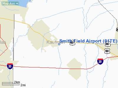
Location & QuickFacts
| FAA Information Effective: | 2008-09-25 |
| Airport Identifier: | 01TE |
| Airport Status: | Operational |
| Longitude/Latitude: | 096-25-40.9460W/32-44-15.4650N
-96.428041/32.737629 (Estimated) |
| Elevation: | 505 ft / 153.92 m (Estimated) |
| Land: | 20 acres |
| From nearest city: | 2 nautical miles SE of Forney, TX |
| Location: | Kaufman County, TX |
| Magnetic Variation: | 06E (1985) |
Owner & Manager
| Ownership: | Privately owned |
| Owner: | James Smith |
| Address: | 108 South County Rd.
Forney, TX 75126 |
| Phone number: | 214-552-9622 |
| Manager: | James Smith |
| Address: | 108 South County Rd.
Forney, TX 75126 |
| Phone number: | 214-222-8338 |
Airport Operations and Facilities
| Airport Use: | Private |
| Wind indicator: | Yes |
| Segmented Circle: | No |
| Control Tower: | No |
| Landing fee charge: | No |
| Sectional chart: | Dallas-ft Worth |
| Region: | ASW - Southwest |
| Boundary ARTCC: | ZFW - Fort Worth |
| Tie-in FSS: | FTW - Fort Worth |
| FSS on Airport: | No |
| FSS Phone: | 817-541-3474 |
| FSS Toll Free: | 1-800-WX-BRIEF |
Airport Services
| Airframe Repair: | MAJOR |
| Power Plant Repair: | MAJOR |
| Bottled Oxygen: | NONE |
| Bulk Oxygen: | NONE |
Runway Information
Runway 04/22
| Dimension: | 2433 x 55 ft / 741.6 x 16.8 m
CULVERT UNDER RY 700' NE RWY 04 THR RESTRICTS RY WIDTH TO 55'. |
| Surface: | TURF, Fair Condition |
| |
Runway 04 |
Runway 22 |
| Traffic Pattern: | Left | Left |
| Obstruction: | , 50:1 slope to clear | 15 ft road, 20.0 ft from runway, 1:1 slope to clear |
|
Radio Navigation Aids
| ID |
Type |
Name |
Ch |
Freq |
Var |
Dist |
| PQF | NDB | Mesquite | | 248.00 | 06E | 6.7 nm |
| JUG | NDB | Jecca | | 388.00 | 06E | 6.7 nm |
| AVZ | NDB | Travis | | 260.00 | 06E | 9.1 nm |
| LNC | NDB | Lancaster | | 239.00 | 06E | 17.7 nm |
| MII | NDB | Caddo Mills | | 316.00 | 06E | 20.3 nm |
| RBD | NDB | Redbird | | 287.00 | 06E | 22.7 nm |
| SYW | NDB | Cash | | 428.00 | 05E | 23.4 nm |
| XQH | NDB | Cedar Hill | | 353.00 | 08E | 29.1 nm |
| CGQ | NDB | Powell | | 344.00 | 06E | 40.5 nm |
| CRS | NDB | Corsicana | | 396.00 | 06E | 42.7 nm |
| AHX | NDB | Athens | | 269.00 | 06E | 46.1 nm |
| CSZ | NDB | Crossroads | | 215.00 | 08E | 47.0 nm |
| LIQ | NDB | Lochridge Ranch | | 335.00 | 09E | 49.9 nm |
| MJF | TACAN | Arvilla | 033X | | 05E | 27.1 nm |
| CVE | VOR/DME | Cowboy | 109X | 116.20 | 06E | 25.7 nm |
| TTT | VOR/DME | Maverick | 078X | 113.10 | 06E | 31.9 nm |
| CQY | VORTAC | Cedar Creek | 095X | 114.80 | 06E | 34.8 nm |
| FUZ | VORTAC | Ranger | 104X | 115.70 | 06E | 39.0 nm |
| BYP | VORTAC | Bonham | 093X | 114.60 | 06E | 49.1 nm |
| DAL | VOT | Dallas Love Field | | 113.30 | | 22.4 nm |
| FTW | VOT | Fort Worth Meacham | | 108.20 | | 47.3 nm |
Remarks
- +4' FENCE 100' EAST OF RWY: 675' NE OF RWY 04 THR OBSTRUCTS PRIMARY SFC.
- CAUTION: RWY 04/22 SOFT IN WET WEATHER.
- VFR OPNS ONLY PRVDD NE RWY END LCTD FAR ENOUGH FROM ROADWAY THAT AN APCH SLOPE OF 20:1 WILL CLEAR ROADWAY BY 15' VERTICAL DSTC AND PLINE.
Images and information placed above are from
http://www.airport-data.com/airport/01TE/
We thank them for the data!
| General Info
|
| Country |
United States
|
| State |
TEXAS
|
| FAA ID |
01TE
|
| Latitude |
32-44-15.465N
|
| Longitude |
096-25-40.946W
|
| Elevation |
505 feet
|
| Near City |
FORNEY
|
We don't guarantee the information is fresh and accurate. The data may
be wrong or outdated.
For more up-to-date information please refer to other sources.
|
|


