 |
|
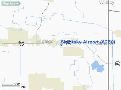
Location & QuickFacts
| FAA Information Effective: | 2008-09-25 |
| Airport Identifier: | 6TE0 |
| Airport Status: | Operational |
| Longitude/Latitude: | 097-56-58.0050W/26-17-25.2580N
-97.949446/26.290349 (Estimated) |
| Elevation: | 60 ft / 18.29 m (Estimated) |
| Land: | 0 acres |
| From nearest city: | 1 nautical miles E of Edcouch, TX |
| Location: | Hidalgo County, TX |
| Magnetic Variation: | 07E (1985) |
Owner & Manager
| Ownership: | Privately owned |
| Owner: | Rio Grande Aviation |
| Address: | P.o. Box 253
Edcouch, TX 78538 |
| Phone number: | 512-262-3023 |
| Manager: | Larry & James Skalitsky |
| Address: | P.o. Box 253
Edcouch, TX 78538 |
| Phone number: | 512-262-3023 |
Airport Operations and Facilities
| Airport Use: | Private |
| Wind indicator: | Yes |
| Segmented Circle: | No |
| Control Tower: | No |
| Landing fee charge: | No |
| Sectional chart: | Brownsville |
| Region: | ASW - Southwest |
| Boundary ARTCC: | ZHU - Houston |
| Tie-in FSS: | SJT - San Angelo |
| FSS on Airport: | No |
| FSS Toll Free: | 1-800-WX-BRIEF |
Airport Services
| Airframe Repair: | NONE |
| Power Plant Repair: | NONE |
Runway Information
Runway 08/26
| Dimension: | 2500 x 150 ft / 762.0 x 45.7 m |
| Surface: | TURF, |
| |
Runway 08 |
Runway 26 |
| Traffic Pattern: | Left | Left |
| Obstruction: | 7 ft berm | |
|
Runway 17/35
| Dimension: | 1350 x 100 ft / 411.5 x 30.5 m |
| Surface: | TURF, |
| |
Runway 17 |
Runway 35 |
| Traffic Pattern: | Left | Left |
| Obstruction: | 7 ft berm | |
|
Radio Navigation Aids
| ID |
Type |
Name |
Ch |
Freq |
Var |
Dist |
| SNE | NDB | Santa Elena | | 260.00 | 07E | 42.5 nm |
| REX | VOR | Reynosa | | 112.40 | 08E | 22.5 nm |
| HRL | VOR/DME | Harlingen | 029X | 109.20 | 05E | 16.5 nm |
| MFE | VOR/DME | Mc Allen | 119X | 117.20 | 09E | 17.2 nm |
| MAM | VOR/DME | Matamoros | 090X | 114.30 | 07E | 38.8 nm |
| BRO | VORTAC | Brownsville | 110X | 116.30 | 09E | 38.0 nm |
Images and information placed above are from
http://www.airport-data.com/airport/6TE0/
We thank them for the data!
| General Info
|
| Country |
United States
|
| State |
TEXAS
|
| FAA ID |
6TE0
|
| Latitude |
26-17-25.258N
|
| Longitude |
097-56-58.005W
|
| Elevation |
60 feet
|
| Near City |
EDCOUCH
|
We don't guarantee the information is fresh and accurate. The data may
be wrong or outdated.
For more up-to-date information please refer to other sources.
|
|


