 |
|
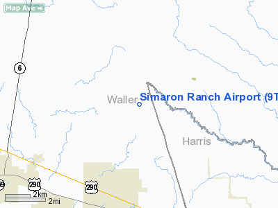
Location & QuickFacts
| FAA Information Effective: | 2008-09-25 |
| Airport Identifier: | 9TS3 |
| Airport Status: | Operational |
| Longitude/Latitude: | 095-58-00.8390W/30-08-53.7760N
-95.966900/30.148271 (Estimated) |
| Elevation: | 310 ft / 94.49 m (Estimated) |
| Land: | 10 acres |
| From nearest city: | 6 nautical miles NW of Waller, TX |
| Location: | Waller County, TX |
| Magnetic Variation: | 06E (1985) |
Owner & Manager
| Ownership: | Privately owned |
| Owner: | Charles D. Sims |
| Address: | Rte 1 Box 412-d
Hempstead, TX 77445 |
| Phone number: | 409-826-3554 |
| Manager: | Robert Schmid |
| Address: | Rte 1 Box 412-d
Hempstead, TX 77445 |
| Phone number: | 409-826-8314 |
Airport Operations and Facilities
| Airport Use: | Private |
| Wind indicator: | Yes |
| Segmented Circle: | No |
| Control Tower: | No |
| Lighting Schedule: | RDO-CTL
ACTVT LIRL RWY 17/35 - 122.7. |
| Beacon Color: | Clear-Green (lighted land airport) |
| Landing fee charge: | No |
| Sectional chart: | Houston |
| Region: | ASW - Southwest |
| Boundary ARTCC: | ZHU - Houston |
| Tie-in FSS: | CXO - Montgomery County |
| FSS on Airport: | No |
| FSS Toll Free: | 1-800-WX-BRIEF
FOR FP FILING CALL CXO FSS 1-800-833-5602. |
Runway Information
Runway 17/35
| Dimension: | 3000 x 25 ft / 914.4 x 7.6 m |
| Surface: | ASPH, |
| Edge Lights: | Low |
| |
Runway 17 |
Runway 35 |
| Traffic Pattern: | Left | Left |
| Obstruction: | | 70 ft pline, 1500.0 ft from runway |
|
Radio Navigation Aids
| ID |
Type |
Name |
Ch |
Freq |
Var |
Dist |
| DWH | NDB | David Hooks | | 521.00 | 05E | 20.9 nm |
| EYQ | NDB | Weiser | | 286.00 | 06E | 21.3 nm |
| BNH | NDB | Brenham | | 362.00 | 06E | 21.6 nm |
| LYD | NDB | Lakeside | | 249.00 | 05E | 25.0 nm |
| SGR | NDB | Hull | | 388.00 | 05E | 35.0 nm |
| BVP | NDB | Nixin | | 326.00 | 05E | 40.2 nm |
| UTS | NDB | Huntsville | | 308.00 | 06E | 40.6 nm |
| SYG | NDB | Sandy Point | | 402.00 | 05E | 46.7 nm |
| ELA | VOR/DME | Eagle Lake | 111X | 116.40 | 08E | 34.4 nm |
| HUB | VOR/DME | Hobby | 118X | 117.10 | 05E | 46.6 nm |
| TNV | VORTAC | Navasota | 106X | 115.90 | 08E | 9.7 nm |
| IDU | VORTAC | Industry | 039X | 110.20 | 08E | 33.1 nm |
| IAH | VORTAC | Humble | 113X | 116.60 | 05E | 34.3 nm |
| CLL | VORTAC | College Station | 080X | 113.30 | 08E | 36.2 nm |
| HOU | VOT | Houston Wm P Hobby | | 108.40 | | 46.9 nm |
Images and information placed above are from
http://www.airport-data.com/airport/9TS3/
We thank them for the data!
| General Info
|
| Country |
United States
|
| State |
TEXAS
|
| FAA ID |
9TS3
|
| Latitude |
30-08-53.776N
|
| Longitude |
095-58-00.839W
|
| Elevation |
310 feet
|
| Near City |
WALLER
|
We don't guarantee the information is fresh and accurate. The data may
be wrong or outdated.
For more up-to-date information please refer to other sources.
|
|


