 |
|
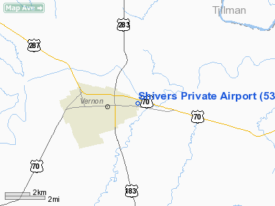
Location & QuickFacts
| FAA Information Effective: | 2008-09-25 |
| Airport Identifier: | 53TA |
| Airport Status: | Operational |
| Longitude/Latitude: | 099-15-51.2890W/34-09-15.3100N
-99.264247/34.154253 (Estimated) |
| Elevation: | 1215 ft / 370.33 m (Estimated) |
| Land: | 0 acres |
| From nearest city: | 0 nautical miles E of Vernon, TX |
| Location: | Wilbarger County, TX |
| Magnetic Variation: | 08E (1985) |
Owner & Manager
| Ownership: | Privately owned |
| Owner: | B.r. Shivers |
| Address: | 1718 Wanda Dr.
Vernon, TX 76384 |
| Phone number: | 817-552-2292 |
| Manager: | B.r. Shivers |
| Address: | 1718 Wanda Dr.
Vernon, TX 76384 |
| Phone number: | 817-552-2292 |
Airport Operations and Facilities
| Airport Use: | Private |
| Wind indicator: | No |
| Segmented Circle: | No |
| Control Tower: | No |
| Landing fee charge: | No |
| Sectional chart: | Dallas-ft Worth |
| Region: | ASW - Southwest |
| Boundary ARTCC: | ZFW - Fort Worth |
| Tie-in FSS: | FTW - Fort Worth |
| FSS on Airport: | No |
| FSS Phone: | 817-541-3474 |
| FSS Toll Free: | 1-800-WX-BRIEF |
Runway Information
Runway 17/35
| Dimension: | 1800 x 75 ft / 548.6 x 22.9 m |
| Surface: | TURF, |
| |
Runway 17 |
Runway 35 |
| Traffic Pattern: | Left | Left |
|
Radio Navigation Aids
| ID |
Type |
Name |
Ch |
Freq |
Var |
Dist |
| VRT | NDB | Wilbarger | | 230.00 | 08E | 4.4 nm |
| SKB | NDB | Scotland | | 344.00 | 08E | 44.5 nm |
| SHP | TACAN | Sheppard | 045X | | 10E | 40.0 nm |
| LAW | VOR/DME | Lawton | 031X | 109.40 | 09E | 47.0 nm |
| LTS | VORTAC | Altus | 035X | 109.80 | 08E | 30.6 nm |
| SPS | VORTAC | Wichita Falls | 074X | 112.70 | 10E | 34.9 nm |
| HBR | VORTAC | Hobart | 055X | 111.80 | 10E | 44.0 nm |
Remarks
- 500' TOWER 500' WEST.
- CONDL--PRVDD LNDG THRESHOLDS ARE DSPLCD A SUFFICIENT DISTANCE TO PROVIDE PROPER CLEARANCE OVER ROADS AND THE USE OF FACILITY IS RESTRICTED TO PERSONAL USE.
Images and information placed above are from
http://www.airport-data.com/airport/53TA/
We thank them for the data!
| General Info
|
| Country |
United States
|
| State |
TEXAS
|
| FAA ID |
53TA
|
| Latitude |
34-09-15.310N
|
| Longitude |
099-15-51.289W
|
| Elevation |
1215 feet
|
| Near City |
VERNON
|
We don't guarantee the information is fresh and accurate. The data may
be wrong or outdated.
For more up-to-date information please refer to other sources.
|
|


