 |
|
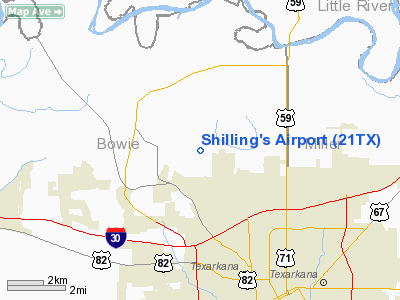
Location & QuickFacts
| FAA Information Effective: | 2008-09-25 |
| Airport Identifier: | 21TX |
| Airport Status: | Operational |
| Longitude/Latitude: | 094-05-39.6880W/33-29-58.4430N
-94.094358/33.499567 (Estimated) |
| Elevation: | 350 ft / 106.68 m (Estimated) |
| Land: | 0 acres |
| From nearest city: | 2 nautical miles NW of Texarkana, TX |
| Location: | Bowie County, TX |
| Magnetic Variation: | 05E (1985) |
Owner & Manager
| Ownership: | Privately owned |
| Owner: | William E Shilling |
| Address: | Route 3, Box 491-hb
Texarkana, TX 75503 |
| Phone number: | 903-793-0881 |
| Manager: | Donald Shilling |
| Address: | Route 3, Box 491-hb
Texarkana, TX 75503 |
| Phone number: | 903-792-6660 |
Airport Operations and Facilities
| Airport Use: | Private |
| Wind indicator: | Yes |
| Segmented Circle: | No |
| Control Tower: | No |
| Landing fee charge: | No |
| Sectional chart: | Memphis |
| Region: | ASW - Southwest |
| Boundary ARTCC: | ZFW - Fort Worth |
| Tie-in FSS: | FTW - Fort Worth |
| FSS on Airport: | No |
| FSS Phone: | 817-541-3474 |
| FSS Toll Free: | 1-800-WX-BRIEF |
Airport Communications
Airport Services
| Fuel available: | 100LL |
| Airframe Repair: | MAJOR |
| Power Plant Repair: | NONE |
Runway Information
Runway 09/27
| Dimension: | 2800 x 75 ft / 853.4 x 22.9 m |
| Surface: | TURF, |
| |
Runway 09 |
Runway 27 |
| Traffic Pattern: | Left | Left |
|
Radio Navigation Aids
| ID |
Type |
Name |
Ch |
Freq |
Var |
Dist |
| ATA | NDB | Atlanta | | 347.00 | 04E | 24.3 nm |
| HPC | NDB | Hope | | 362.00 | 03E | 25.9 nm |
| DEQ | NDB | De Queen | | 281.00 | 04E | 36.2 nm |
| VIV | NDB | Vivian | | 284.00 | 06E | 38.7 nm |
| IBO | NDB | Idabel | | 271.00 | 03E | 44.7 nm |
| AGO | NDB | Magnolia | | 266.00 | 04E | 47.1 nm |
| LST | NDB | Lone Star | | 305.00 | 05E | 47.4 nm |
| SPH | NDB | Springhill | | 375.00 | 05E | 49.0 nm |
| TXK | VORTAC | Texarkana | 110X | 116.30 | 07E | 1.4 nm |
| EIC | VORTAC | Belcher | 121X | 117.40 | 07E | 46.1 nm |
Remarks
- TFC PATTERNS TO BE COMPATIBLE WITH THOSE FOR TEXARKANA MUNI-WEBB FLD.
Images and information placed above are from
http://www.airport-data.com/airport/21TX/
We thank them for the data!
| General Info
|
| Country |
United States
|
| State |
TEXAS
|
| FAA ID |
21TX
|
| Latitude |
33-29-58.443N
|
| Longitude |
094-05-39.688W
|
| Elevation |
350 feet
|
| Near City |
TEXARKANA
|
We don't guarantee the information is fresh and accurate. The data may
be wrong or outdated.
For more up-to-date information please refer to other sources.
|
|


