 |
|
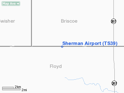
Location & QuickFacts
| FAA Information Effective: | 2008-09-25 |
| Airport Identifier: | TS39 |
| Airport Status: | Operational |
| Longitude/Latitude: | 101-24-43.5920W/34-18-43.2450N
-101.412109/34.312013 (Estimated) |
| Elevation: | 3285 ft / 1001.27 m (Estimated) |
| Land: | 10 acres |
| From nearest city: | 14 nautical miles NN of Lockney, TX |
| Location: | Floyd County, TX |
| Magnetic Variation: | 09E (1985) |
Owner & Manager
| Ownership: | Privately owned |
| Owner: | Lyndall Stapp |
| Address: | Route 1, Box 432
Lockney, TX 79241 |
| Address: |
|
Airport Operations and Facilities
| Airport Use: | Private |
| Segmented Circle: | No |
| Control Tower: | No |
| Sectional chart: | Dallas-ft Worth |
| Region: | ASW - Southwest |
| Boundary ARTCC: | ZFW - Fort Worth |
| Tie-in FSS: | FTW - Fort Worth |
| FSS Phone: | 817-541-3474 |
| FSS Toll Free: | 1-800-WX-BRIEF |
Runway Information
Runway 17/35
| Dimension: | 4000 x 60 ft / 1219.2 x 18.3 m |
| Surface: | TURF, |
| |
Runway 17 |
Runway 35 |
| Traffic Pattern: | Left | Left |
| Obstruction: | | 25 ft pline, 1200.0 ft from runway |
|
Radio Navigation Aids
| ID |
Type |
Name |
Ch |
Freq |
Var |
Dist |
| CZX | NDB | Crosbyton | | 332.00 | 09E | 42.2 nm |
| PVW | VOR/DME | Plainview | 076X | 112.90 | 11E | 23.2 nm |
| LBB | VORTAC | Lubbock | 029X | 109.20 | 11E | 44.2 nm |
Images and information placed above are from
http://www.airport-data.com/airport/TS39/
We thank them for the data!
| General Info
|
| Country |
United States
|
| State |
TEXAS
|
| FAA ID |
TS39
|
| Latitude |
34-18-43.245N
|
| Longitude |
101-24-43.592W
|
| Elevation |
3285 feet
|
| Near City |
LOCKNEY
|
We don't guarantee the information is fresh and accurate. The data may
be wrong or outdated.
For more up-to-date information please refer to other sources.
|
|


