 |
|
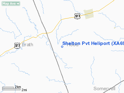
Location & QuickFacts
| FAA Information Effective: | 2008-09-25 |
| Airport Identifier: | XA69 |
| Airport Status: | Operational |
| Longitude/Latitude: | 097-58-10.0000W/32-20-10.0000N
-97.969444/32.336111 (Estimated) |
| Elevation: | 1070 ft / 326.14 m (Estimated) |
| Land: | 0 acres |
| From nearest city: | 6 nautical miles SW of Tolar, TX |
| Location: | Hood County, TX |
| Magnetic Variation: | () |
Owner & Manager
| Ownership: | Privately owned |
| Owner: | Mark Edward Shelton |
| Address: | 11901 Stonecrest Ct
Tolar, TX 76476 |
| Phone number: | 254-835-4686 |
| Manager: | Mark Shelton |
| Address: | 11901 Stonecrest Ct
Tolar, TX 76476 |
| Phone number: | 254-835-4686 |
Airport Operations and Facilities
| Airport Use: | Private |
| Wind indicator: | Yes |
| Control Tower: | No |
| Sectional chart: | Dallas-ft Worth |
| Region: | ASW - Southwest |
| Boundary ARTCC: | ZFW - Fort Worth |
| Tie-in FSS: | FTW - Fort Worth |
| FSS Phone: | 817-541-3474 |
| FSS Toll Free: | 1-800-WX-BRIEF |
Runway Information
Helipad H1
| Dimension: | 50 x 50 ft / 15.2 x 15.2 m |
| Surface: | TURF, |
| |
Runway H1 |
Runway |
| Traffic Pattern: | Left | Left |
|
Radio Navigation Aids
| ID |
Type |
Name |
Ch |
Freq |
Var |
Dist |
| MWL | NDB | Mineral Wells | | 266.00 | 06E | 27.4 nm |
| OIP | NDB | Old Rip | | 410.00 | 07E | 42.9 nm |
| GZV | NDB | Brazos River | | 280.00 | 07E | 43.3 nm |
| MNZ | NDB | Hamilton | | 251.00 | 07E | 44.0 nm |
| NFW | TACAN | Nas Jrb Fort Worth | 024X | | 07E | 37.5 nm |
| JEN | VORTAC | Glen Rose | 097X | 115.00 | 06E | 11.6 nm |
| MQP | VORTAC | Millsap | 124X | 117.70 | 09E | 23.5 nm |
| FTW | VOT | Fort Worth Meacham | | 108.20 | | 42.4 nm |
Images and information placed above are from
http://www.airport-data.com/airport/XA69/
We thank them for the data!
|
|


