 |
|
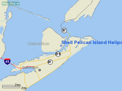
Shell Pelican Island Heliport |
Location & QuickFacts
| FAA Information Effective: | 2008-09-25 |
| Airport Identifier: | 9TE8 |
| Airport Status: | Operational |
| Longitude/Latitude: | 094-47-12.7040W/29-19-21.8500N
-94.786862/29.322736 (Estimated) |
| Elevation: | 10 ft / 3.05 m (Estimated) |
| Land: | 0 acres |
| From nearest city: | 2 nautical miles NE of Galveston, TX |
| Location: | Galveston County, TX |
| Magnetic Variation: | 05E (1985) |
Owner & Manager
| Ownership: | Privately owned |
| Owner: | Shell Offshore Inc |
| Address: | P.o. Box 61933
New Orleans, LA 70161 |
| Phone number: | 713-588-4591 |
| Manager: | J E Whitman |
| Address: | P.o. Box 60193
New Orleans, LA 70160 |
| Phone number: | 504-588-4591 |
Airport Operations and Facilities
| Airport Use: | Private |
| Wind indicator: | Yes |
| Segmented Circle: | No |
| Control Tower: | No |
| Sectional chart: | Houston |
| Region: | ASW - Southwest |
| Boundary ARTCC: | ZHU - Houston |
| Tie-in FSS: | CXO - Montgomery County |
| FSS on Airport: | No |
| FSS Toll Free: | 1-800-WX-BRIEF
FOR FP FILING CALL CXO FSS 1-800-833-5602. |
Airport Services
| Fuel available: | A1
FUEL PPR CALL 409-740-1281. |
Runway Information
Helipad H1
| Dimension: | 35 x 35 ft / 10.7 x 10.7 m |
| Surface: | CONC, |
| |
Runway H1 |
Runway |
| Traffic Pattern: | Left | Left |
|
Helipad H2
| Dimension: | 35 x 35 ft / 10.7 x 10.7 m |
| Surface: | CONC, |
| |
Runway H2 |
Runway |
| Traffic Pattern: | Left | Left |
|
Radio Navigation Aids
| ID |
Type |
Name |
Ch |
Freq |
Var |
Dist |
| GLS | NDB | Galveston | | 206.00 | 08E | 1.7 nm |
| JPA | NDB | Sanjac | | 347.00 | 05E | 25.5 nm |
| CBC | NDB | Anahuac | | 413.00 | 05E | 27.8 nm |
| SYG | NDB | Sandy Point | | 402.00 | 05E | 37.3 nm |
| BVP | NDB | Nixin | | 326.00 | 05E | 46.1 nm |
| SGR | NDB | Hull | | 388.00 | 05E | 49.1 nm |
| EFD | TACAN | Ellington | 031X | | 05E | 25.9 nm |
| MHF | VOR/DME | Trinity | 083X | 113.60 | 07E | 13.6 nm |
| HUB | VOR/DME | Hobby | 118X | 117.10 | 05E | 32.5 nm |
| SBI | VOR/DME | Sabine Pass | 101X | 115.40 | 07E | 44.9 nm |
| VUH | VORTAC | Scholes | 077X | 113.00 | 06E | 5.3 nm |
| IAH | VORTAC | Humble | 113X | 116.60 | 05E | 48.0 nm |
| HOU | VOT | Houston Wm P Hobby | | 108.40 | | 32.2 nm |
Images and information placed above are from
http://www.airport-data.com/airport/9TE8/
We thank them for the data!
| General Info
|
| Country |
United States
|
| State |
TEXAS
|
| FAA ID |
9TE8
|
| Latitude |
29-19-21.850N
|
| Longitude |
094-47-12.704W
|
| Elevation |
10 feet
|
| Near City |
GALVESTON
|
We don't guarantee the information is fresh and accurate. The data may
be wrong or outdated.
For more up-to-date information please refer to other sources.
|
|


