 |
|
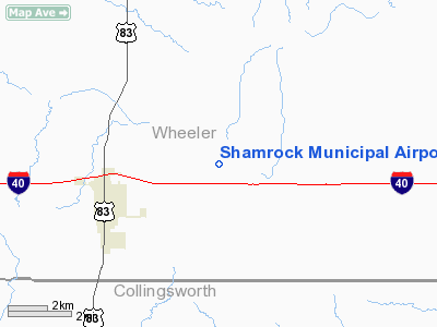
Location & QuickFacts
| FAA Information Effective: | 2008-09-25 |
| Airport Identifier: | 2F1 |
| Airport Status: | Operational |
| Longitude/Latitude: | 100-11-05.4160W/35-14-10.1820N
-100.184838/35.236162 (Estimated) |
| Elevation: | 2369 ft / 722.07 m (Estimated) |
| Land: | 95 acres |
| From nearest city: | 3 nautical miles NE of Shamrock, TX |
| Location: | Wheeler County, TX |
| Magnetic Variation: | 08E (1985) |
Owner & Manager
| Ownership: | Publicly owned |
| Owner: | City Of Shamrock |
| Address: | 116 W 2nd St
Shamrock, TX 79079 |
| Phone number: | 806-256-3281 |
| Manager: | Becky Brown |
| Address: | 116 W. 20th Street
Shamrock, TX 79079 |
| Phone number: | 806-256-3281 |
Airport Operations and Facilities
| Airport Use: | Open to public |
| Wind indicator: | Yes |
| Segmented Circle: | Yes |
| Control Tower: | No |
| Lighting Schedule: | DUSK-DAWN
FOR MIRL RY 17/35 AFT 0000 ACTVT - CTAF. |
| Beacon Color: | Clear-Green (lighted land airport) |
| Landing fee charge: | No |
| Sectional chart: | Dallas-ft Worth |
| Region: | ASW - Southwest |
| Traffic Pattern Alt: | 1000 ft |
| Boundary ARTCC: | ZAB - Albuquerque |
| Tie-in FSS: | FTW - Fort Worth |
| FSS on Airport: | No |
| FSS Phone: | 817-541-3474 |
| FSS Toll Free: | 1-800-WX-BRIEF |
| NOTAMs Facility: | FTW (NOTAM-d service avaliable) |
| Federal Agreements: | 1Y |
Airport Communications
| CTAF: | 122.800 |
| Unicom: | 122.800 |
Airport Services
| Fuel available: | 100LLMOGAS
FUEL SELF SERVICE WITH CREDIT CARD. |
| Airframe Repair: | NONE |
| Power Plant Repair: | NONE |
| Bottled Oxygen: | NONE |
| Bulk Oxygen: | NONE |
Runway Information
Runway 17/35
| Dimension: | 3600 x 60 ft / 1097.3 x 18.3 m |
| Surface: | ASPH, Good Condition |
| Weight Limit: | Single wheel: 15000 lbs. |
| Edge Lights: | Medium |
| |
Runway 17 |
Runway 35 |
| Traffic Pattern: | Left | Left |
| Markings: | Basic, Fair Condition | Basic, Fair Condition |
| Obstruction: | 24 ft tree, 550.0 ft from runway, 80 ft right of centerline, 14:1 slope to clear | 60 ft tree, 1250.0 ft from runway, 180 ft right of centerline, 17:1 slope to clear |
|
Radio Navigation Aids
| ID |
Type |
Name |
Ch |
Freq |
Var |
Dist |
| EZY | NDB | Elk City | | 241.00 | 08E | 40.2 nm |
| HHF | NDB | Hemphill County | | 400.00 | 08E | 40.8 nm |
| PPA | NDB | Pampa | | 368.00 | 09E | 45.6 nm |
| BZ | NDB | Fossi | | 393.00 | 08E | 49.9 nm |
| SYO | VORTAC | Sayre | 099X | 115.20 | 10E | 27.7 nm |
| BFV | VORTAC | Burns Flat | 037X | 110.00 | 08E | 48.0 nm |
Images and information placed above are from
http://www.airport-data.com/airport/2F1/
We thank them for the data!
| General Info
|
| Country |
United States
|
| State |
TEXAS
|
| FAA ID |
2F1
|
| Latitude |
35-14-10.182N
|
| Longitude |
100-11-05.416W
|
| Elevation |
2369 feet
|
| Near City |
SHAMROCK
|
We don't guarantee the information is fresh and accurate. The data may
be wrong or outdated.
For more up-to-date information please refer to other sources.
|
|


