 |
|
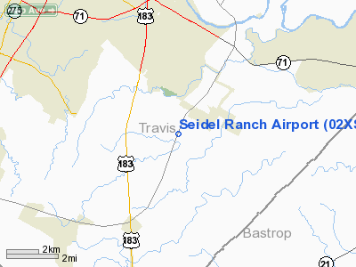
Location & QuickFacts
| FAA Information Effective: | 2008-09-25 |
| Airport Identifier: | 02XS |
| Airport Status: | Operational |
| Longitude/Latitude: | 097-39-46.0050W/30-08-51.7670N
-97.662779/30.147713 (Estimated) |
| Elevation: | 510 ft / 155.45 m (Estimated) |
| Land: | 0 acres |
| From nearest city: | 2 nautical miles NW of Elroy, TX |
| Location: | Travis County, TX |
| Magnetic Variation: | 07E (1985) |
Owner & Manager
| Ownership: | Privately owned |
| Owner: | William G Seidel |
| Address: | P.o. Box 207
Del Valle, TX 78617-0207 |
| Phone number: | 512-247-4397 |
| Manager: | William G Seidel |
| Address: | P.o. Box 207
Del Valle, TX 78617-0207 |
| Phone number: | 512-247-4397 |
Airport Operations and Facilities
| Airport Use: | Private |
| Wind indicator: | Yes |
| Segmented Circle: | No |
| Control Tower: | No |
| Landing fee charge: | No |
| Sectional chart: | San Antonio |
| Region: | ASW - Southwest |
| Boundary ARTCC: | ZHU - Houston |
| Tie-in FSS: | SJT - San Angelo |
| FSS on Airport: | No |
| FSS Toll Free: | 1-800-WX-BRIEF |
Runway Information
Runway 02/20
| Dimension: | 1500 x 40 ft / 457.2 x 12.2 m |
| Surface: | TURF, |
| |
Runway 02 |
Runway 20 |
| Traffic Pattern: | Right | Left |
| Obstruction: | 4 ft fence | 25 ft plines, 255.0 ft from runway |
|
Runway 11/29
| Dimension: | 1320 x 40 ft / 402.3 x 12.2 m |
| Surface: | TURF, |
| |
Runway 11 |
Runway 29 |
| Traffic Pattern: | Left | Left |
|
Radio Navigation Aids
| ID |
Type |
Name |
Ch |
Freq |
Var |
Dist |
| GUO | NDB | Georgetown | | 332.00 | 06E | 32.3 nm |
| GYB | NDB | Lee County | | 385.00 | 07E | 35.6 nm |
| MFS | NDB | Horseshoe Bay Resort | | 403.00 | 07E | 42.5 nm |
| BMQ | NDB | Burnet | | 341.00 | 07E | 46.4 nm |
| DHK | TACAN | Randolph | 036X | | 09E | 48.4 nm |
| CWK | VORTAC | Centex | 075X | 112.80 | 06E | 15.5 nm |
| RND | VORTAC | Randolph | 70X | 112.30 | 09E | 49.8 nm |
Remarks
- RWY SOFT WHEN WET; LIVESTOCK MAY BE ON RWY.
- REMOVABLE 3' FENCE CROSSES RWY 11/29 AT TWO LOCATIONS--APPROX 175' AND 625' DOWN RWY FROM APCH END RWY 29.
- VFR USE. ESTABLISH AN OPNL LETTER OF AGREEMENT WITH USAF, BERGSTROM AFB, TX.
Images and information placed above are from
http://www.airport-data.com/airport/02XS/
We thank them for the data!
| General Info
|
| Country |
United States
|
| State |
TEXAS
|
| FAA ID |
02XS
|
| Latitude |
30-08-51.767N
|
| Longitude |
097-39-46.005W
|
| Elevation |
510 feet
|
| Near City |
ELROY
|
We don't guarantee the information is fresh and accurate. The data may
be wrong or outdated.
For more up-to-date information please refer to other sources.
|
|


