 |
|
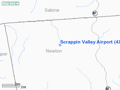
Location & QuickFacts
| FAA Information Effective: | 2008-09-25 |
| Airport Identifier: | 4XS5 |
| Airport Status: | Operational |
| Longitude/Latitude: | 093-48-10.6540W/31-07-18.6920N
-93.802959/31.121859 (Estimated) |
| Elevation: | 350 ft / 106.68 m (Estimated) |
| Land: | 0 acres |
| From nearest city: | 9 nautical miles NW of Wiergate, TX |
| Location: | Newton County, TX |
| Magnetic Variation: | 05E (1985) |
Owner & Manager
| Ownership: | Privately owned |
| Owner: | Temple Inland Inc |
| Address: | Drawer N
Diboll, TX 75941 |
| Phone number: | 409-829-1691 |
| Manager: | Joe Hamlick |
| Address: | P.o.box 68
Pineland, TX 75968 |
| Phone number: | 409-565-4587 |
Airport Operations and Facilities
| Airport Use: | Private |
| Wind indicator: | Yes |
| Segmented Circle: | No |
| Control Tower: | No |
| Sectional chart: | Houston |
| Region: | ASW - Southwest |
| Boundary ARTCC: | ZHU - Houston |
| Tie-in FSS: | CXO - Montgomery County |
| FSS on Airport: | No |
| FSS Toll Free: | 1-800-WX-BRIEF
FOR FP FILING CALL CXO FSS 1-800-833-5602. |
Runway Information
Runway 01/19
| Dimension: | 4000 x 60 ft / 1219.2 x 18.3 m |
| Surface: | TRTD, |
| |
Runway 01 |
Runway 19 |
| Traffic Pattern: | Left | Left |
|
Radio Navigation Aids
| ID |
Type |
Name |
Ch |
Freq |
Var |
Dist |
| POE1 | FAN MARKER | North | | | 07E | 30.0 nm |
| POE | FAN MARKER | South | | | 07E | 34.0 nm |
| JAS | NDB | Jasper | | 344.00 | 04E | 15.6 nm |
| VED | NDB | Leesville | | 247.00 | 04E | 23.8 nm |
| MMY | NDB | Many | | 272.00 | 04E | 30.2 nm |
| GUV | NDB | Gator | | 359.00 | 05E | 32.3 nm |
| DR | NDB | Idder | | 385.00 | 04E | 32.8 nm |
| DQU | NDB | De Quincy | | 410.00 | 05E | 44.8 nm |
| CZJ | NDB | Amason | | 341.00 | 04E | 46.4 nm |
| IE | NDB | Campi | | 407.00 | 04E | 49.2 nm |
| FXU | VORTAC | Polk | 021X | 108.40 | 05E | 30.1 nm |
| LFK | VORTAC | Lufkin | 058X | 112.10 | 05E | 47.1 nm |
Remarks
- RECOMMENDED EMGCY USE ONLY. NEAREST PHONE IS 12 MILES. NEAREST HOUSE IS 6 MILES.
- THIS IS A GAME MANAGEMENT AREA WITH CONTROLLED ACCESS: AREA IS POSTED.
Images and information placed above are from
http://www.airport-data.com/airport/4XS5/
We thank them for the data!
| General Info
|
| Country |
United States
|
| State |
TEXAS
|
| FAA ID |
4XS5
|
| Latitude |
31-07-18.692N
|
| Longitude |
093-48-10.654W
|
| Elevation |
350 feet
|
| Near City |
WIERGATE
|
We don't guarantee the information is fresh and accurate. The data may
be wrong or outdated.
For more up-to-date information please refer to other sources.
|
|


