 |
|
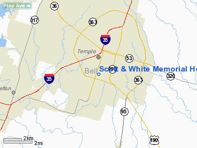
Scott & White Memorial Hospital Heliport |
Location & QuickFacts
| FAA Information Effective: | 2008-09-25 |
| Airport Identifier: | 59XS |
| Airport Status: | Operational |
| Longitude/Latitude: | 097-21-48.0160W/31-04-39.6460N
-97.363338/31.077679 (Estimated) |
| Elevation: | 734 ft / 223.72 m (Estimated) |
| Land: | 0 acres |
| From nearest city: | 0 nautical miles S of Temple, TX |
| Location: | Bell County, TX |
| Magnetic Variation: | 07E (1985) |
Owner & Manager
| Ownership: | Privately owned |
| Owner: | Scott & White Memorial Hosp |
| Address: | 2401 South 31st Street
Temple, TX 76508 |
| Phone number: | 817-774-2111 |
| Manager: | Gary Johnson |
| Address: | 2401 South 31st Street
Temple, TX 76508 |
| Phone number: | 817-724-2301 |
Airport Operations and Facilities
| Airport Use: | Private
MEDICAL. |
| Wind indicator: | Yes |
| Segmented Circle: | No |
| Control Tower: | No |
| Lighting Schedule: | DUSK-DAWN |
| Landing fee charge: | No |
| Sectional chart: | Houston |
| Region: | ASW - Southwest |
| Boundary ARTCC: | ZHU - Houston |
| Tie-in FSS: | SJT - San Angelo |
| FSS on Airport: | No |
| FSS Toll Free: | 1-800-WX-BRIEF |
Runway Information
Helipad H1
| Dimension: | 80 x 80 ft / 24.4 x 24.4 m |
| Surface: | CONC, |
| |
Runway H1 |
Runway |
| Traffic Pattern: | Left | Left |
|
Radio Navigation Aids
| ID |
Type |
Name |
Ch |
Freq |
Var |
Dist |
| IL | NDB | Iresh | | 278.00 | 07E | 18.0 nm |
| HLR | NDB | Hood | | 347.00 | 07E | 18.2 nm |
| GR | NDB | Starn | | 323.00 | 07E | 27.0 nm |
| GUO | NDB | Georgetown | | 332.00 | 06E | 28.7 nm |
| ROB | NDB | Robinson | | 400.00 | 07E | 29.7 nm |
| BMQ | NDB | Burnet | | 341.00 | 07E | 49.4 nm |
| TPL | VOR/DME | Temple | 041X | 110.40 | 09E | 8.5 nm |
| GRK | VOR/DME | Gray | 055X | 111.80 | 07E | 23.3 nm |
| ACT | VORTAC | Waco | 100X | 115.30 | 09E | 35.5 nm |
| LZZ | VORTAC | Lampasas | 072X | 112.50 | 08E | 40.6 nm |
| CWK | VORTAC | Centex | 075X | 112.80 | 06E | 42.9 nm |
Remarks
Images and information placed above are from
http://www.airport-data.com/airport/59XS/
We thank them for the data!
| General Info
|
| Country |
United States
|
| State |
TEXAS
|
| FAA ID |
59XS
|
| Latitude |
31-04-39.646N
|
| Longitude |
097-21-48.016W
|
| Elevation |
734 feet
|
| Near City |
TEMPLE
|
We don't guarantee the information is fresh and accurate. The data may
be wrong or outdated.
For more up-to-date information please refer to other sources.
|
|


