 |
|
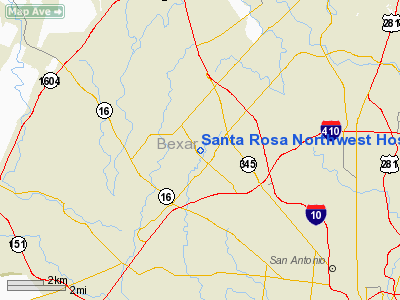
Santa Rosa Northwest Hospital Heliport |
Location & QuickFacts
| FAA Information Effective: | 2008-09-25 |
| Airport Identifier: | TE23 |
| Airport Status: | Operational |
| Longitude/Latitude: | 098-35-19.0710W/29-30-39.8280N
-98.588631/29.511063 (Estimated) |
| Elevation: | 932 ft / 284.07 m (Estimated) |
| Land: | 0 acres |
| From nearest city: | 0 nautical miles N of San Antonio, TX |
| Location: | Bexar County, TX |
| Magnetic Variation: | 07E (1985) |
Owner & Manager
| Ownership: | Privately owned |
| Owner: | Santa Rosa Nw Hospital |
| Address: | 2827 Babcock Road
San Antonio, TX 78229 |
| Phone number: | 512-616-6040 |
| Manager: | Chip Naramore
ASSISTANT VICE PRESIDENT. |
| Address: | 2827 Babcock Road
San Antonio, TX 78229 |
| Phone number: | 512-616-6040 |
Airport Operations and Facilities
| Airport Use: | Private
MEDICAL |
| Wind indicator: | Yes |
| Segmented Circle: | No |
| Control Tower: | No |
| Lighting Schedule: | PHONE REQ
FOR PERIMETER LGTS CALL 512-616-6040 OR 512-616-6061. |
| Sectional chart: | San Antonio |
| Region: | ASW - Southwest |
| Boundary ARTCC: | ZHU - Houston |
| Tie-in FSS: | SJT - San Angelo |
| FSS Toll Free: | 1-800-WX-BRIEF |
Runway Information
Helipad H1
| Dimension: | 50 x 50 ft / 15.2 x 15.2 m |
| Surface: | ASPH, |
| |
Runway H1 |
Runway |
| Traffic Pattern: | Left | Left |
|
Radio Navigation Aids
| ID |
Type |
Name |
Ch |
Freq |
Var |
Dist |
| CVB | NDB | Castroville | | 338.00 | 08E | 16.9 nm |
| HHH | NDB | Devine | | 359.00 | 07E | 29.0 nm |
| HMA | NDB | Hondo | | 329.00 | 08E | 31.6 nm |
| ER | NDB | Shein | | 263.00 | 08E | 32.7 nm |
| PEZ | NDB | Pleasanton | | 275.00 | 07E | 33.6 nm |
| KSY | TACAN | Kelly | 057X | | 07E | 7.2 nm |
| DHK | TACAN | Randolph | 036X | | 09E | 16.9 nm |
| SSF | VOR | Stinson | | 108.40 | 09E | 17.0 nm |
| HDO | VOR/DME | Hondo | 31X | 109.40 | 08E | 32.3 nm |
| SAT | VORTAC | San Antonio | 115X | 116.80 | 08E | 10.4 nm |
| RND | VORTAC | Randolph | 70X | 112.30 | 09E | 15.9 nm |
| CSI | VORTAC | Center Point | 122X | 117.50 | 08E | 41.0 nm |
| STV | VORTAC | Stonewall | 085X | 113.80 | 08E | 42.3 nm |
| SAT | VOT | San Antonio Intl | | 110.40 | | 6.4 nm |
Remarks
- PRVDD A PROCEDURE IS ESTABLISHED TO RESTRICT PEDESTRIAN ACCESS TO THE LANDING AREA DURG HELICOPTER OPERATIONS.
Images and information placed above are from
http://www.airport-data.com/airport/TE23/
We thank them for the data!
| General Info
|
| Country |
United States
|
| State |
TEXAS
|
| FAA ID |
TE23
|
| Latitude |
29-30-39.828N
|
| Longitude |
098-35-19.071W
|
| Elevation |
932 feet
|
| Near City |
SAN ANTONIO
|
We don't guarantee the information is fresh and accurate. The data may
be wrong or outdated.
For more up-to-date information please refer to other sources.
|
|


