 |
|
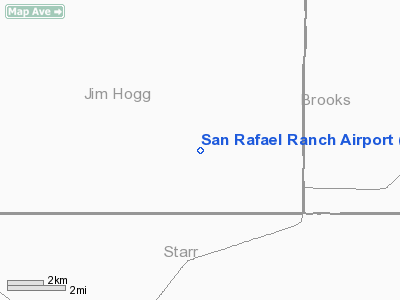
Location & QuickFacts
| FAA Information Effective: | 2008-09-25 |
| Airport Identifier: | 38XS |
| Airport Status: | Operational |
| Longitude/Latitude: | 098-28-45.4000W/26-48-54.7000N
-98.479278/26.815194 (Estimated) |
| Elevation: | 312 ft / 95.10 m (Estimated) |
| Land: | 0 acres |
| From nearest city: | 5 nautical miles N of Santa Elena, TX |
| Location: | Jim Hogg County, TX |
| Magnetic Variation: | 07E (1995) |
Owner & Manager
| Ownership: | Privately owned |
| Owner: | Rancho S. R. Ltd |
| Address: | 12 Greenbriar Lane
Paoli, PA 19301 |
| Phone number: | 713-405-3600 |
| Manager: | Blue Lanam |
| Address: | Po Box 132
San Elena, TX 78591 |
| Phone number: | 956-481-3410 |
Airport Operations and Facilities
| Airport Use: | Private |
| Wind indicator: | Yes |
| Segmented Circle: | Yes |
| Control Tower: | No |
| Lighting Schedule: | PHONE REQ
FOR MIRL RY 14/32 CALL 210-481-3410. |
| Sectional chart: | Brownsville |
| Region: | ASW - Southwest |
| Boundary ARTCC: | ZHU - Houston |
| Tie-in FSS: | SJT - San Angelo |
| FSS on Airport: | No |
| FSS Toll Free: | 1-800-WX-BRIEF |
Airport Communications
Runway Information
Runway 14/32
| Dimension: | 6000 x 75 ft / 1828.8 x 22.9 m |
| Surface: | ASPH, |
| Weight Limit: | Single wheel: 30000 lbs. |
| Edge Lights: | Medium |
| |
Runway 14 |
Runway 32 |
| Traffic Pattern: | Left | Left |
| Markings: | Non-precision instrument, | Non-precision instrument, |
| VASI: | 2-box SAVASI on left side | 2-box SAVASI on left side |
|
Radio Navigation Aids
| ID |
Type |
Name |
Ch |
Freq |
Var |
Dist |
| SNE | NDB | Santa Elena | | 260.00 | 07E | 7.8 nm |
| BKS | NDB | Brooks County | | 353.00 | 06E | 30.3 nm |
| HBV | NDB | Hebbronville | | 266.00 | 06E | 35.3 nm |
| MFE | VOR/DME | Mc Allen | 119X | 117.20 | 09E | 40.6 nm |
Images and information placed above are from
http://www.airport-data.com/airport/38XS/
We thank them for the data!
| General Info
|
| Country |
United States
|
| State |
TEXAS
|
| FAA ID |
38XS
|
| Latitude |
26-49-11.400N
|
| Longitude |
098-29-10.600W
|
| Elevation |
315 feet
|
| Near City |
SANTA ELENA
|
We don't guarantee the information is fresh and accurate. The data may
be wrong or outdated.
For more up-to-date information please refer to other sources.
|
|


