 |
|
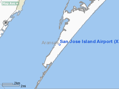
Location & QuickFacts
| FAA Information Effective: | 2008-09-25 |
| Airport Identifier: | XS67 |
| Airport Status: | Operational |
| Longitude/Latitude: | 096-59-05.9570W/27-56-40.0770N
-96.984988/27.944466 (Estimated) |
| Elevation: | 10 ft / 3.05 m (Surveyed) |
| Land: | 0 acres |
| From nearest city: | 6 nautical miles SE of Rockport, TX |
| Location: | Aransas County, TX |
| Magnetic Variation: | 06E (2000) |
Owner & Manager
| Ownership: | Privately owned |
| Owner: | Perry R Bass
BASS BROTHERS ENTERPRISES INC. |
| Address: | 201 Main St.
Ft Worth, TX 76101 |
| Phone number: | 817-390-8400 |
| Manager: | Perry R Bass |
| Address: | 201 Main St.
Ft Worth, TX 76101 |
| Phone number: | 817-335-4591 |
Airport Operations and Facilities
| Airport Use: | Private |
| Wind indicator: | Yes |
| Segmented Circle: | No |
| Control Tower: | No |
| Lighting Schedule: | RDO-CTL
ACTVT MIRL RY 14/32 & VASIS RY 14 & 32 - CTAF. |
| Sectional chart: | Brownsville |
| Region: | ASW - Southwest |
| Boundary ARTCC: | ZHU - Houston |
| Tie-in FSS: | SJT - San Angelo |
| FSS on Airport: | No |
| FSS Toll Free: | 1-800-WX-BRIEF |
Runway Information
Runway 14/32
| Dimension: | 4900 x 60 ft / 1493.5 x 18.3 m |
| Surface: | ASPH, |
| Edge Lights: | Medium
STROBE LGTS. |
| |
Runway 14 |
Runway 32 |
| Longitude: | 096-59-19.6000W | 096-58-51.5200W |
| Latitude: | 27-57-00.4900N | 27-56-18.8700N |
| Elevation: | 4.00 ft | 10.00 ft |
| Traffic Pattern: | Left | Left |
| VASI: | 2-box on left side | 2-box on left side |
|
Radio Navigation Aids
| ID |
Type |
Name |
Ch |
Freq |
Var |
Dist |
| RKP | NDB | Rockport | | 391.00 | 06E | 9.4 nm |
| MNO | NDB | Mellon Ranch | | 375.00 | 06E | 23.3 nm |
| PKV | NDB | Port Lavaca | | 515.00 | 05E | 45.4 nm |
| BEA | NDB | Beeville | | 284.00 | 07E | 49.9 nm |
| NGP | VORTAC | Truax | 087X | 114.00 | 06E | 22.6 nm |
| CRP | VORTAC | Corpus Christi | 102X | 115.50 | 09E | 24.5 nm |
Remarks
- VASIS BOTH ENDS RWY 14/32.
Images and information placed above are from
http://www.airport-data.com/airport/XS67/
We thank them for the data!
| General Info
|
| Country |
United States
|
| State |
TEXAS
|
| FAA ID |
XS67
|
| Latitude |
27-56-40.077N
|
| Longitude |
096-59-05.957W
|
| Elevation |
10 feet
|
| Near City |
ROCKPORT
|
We don't guarantee the information is fresh and accurate. The data may
be wrong or outdated.
For more up-to-date information please refer to other sources.
|
|


