 |
|
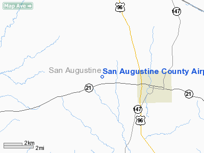
San Augustine County Airport |
Location & QuickFacts
| FAA Information Effective: | 2008-09-25 |
| Airport Identifier: | 78R |
| Airport Status: | Operational |
| Longitude/Latitude: | 094-10-13.7090W/31-32-22.6510N
-94.170475/31.539625 (Estimated) |
| Elevation: | 443 ft / 135.03 m (Surveyed) |
| Land: | 44 acres |
| From nearest city: | 3 nautical miles W of San Augustine, TX |
| Location: | San Augustine County, TX |
| Magnetic Variation: | 05E (1985) |
Owner & Manager
| Ownership: | Publicly owned |
| Owner: | San Augustine County |
| Address: | San Augustine Co Courthouse
San Augustine, TX 75972 |
| Phone number: | 936-275-2762 |
| Manager: | Jerry Smith |
| Address: | County Court House
San Augustine, TX 75972 |
| Phone number: | 936-275-5624
EMERGENCY PHONE: 936-275-2424. |
Airport Operations and Facilities
| Airport Use: | Open to public |
| Wind indicator: | Yes |
| Segmented Circle: | No |
| Control Tower: | No |
| Lighting Schedule: | RDO-CTL
ACTVT ROTG BCN - CTAF. |
| Beacon Color: | Clear-Green (lighted land airport) |
| Landing fee charge: | No |
| Sectional chart: | Houston |
| Region: | ASW - Southwest |
| Boundary ARTCC: | ZHU - Houston |
| Tie-in FSS: | CXO - Montgomery County |
| FSS on Airport: | No |
| FSS Toll Free: | 1-800-WX-BRIEF
FOR FP FILING CALL CXO FSS 1-800-833-5602 |
| NOTAMs Facility: | CXO (NOTAM-d service avaliable) |
Airport Communications
Airport Services
| Airframe Repair: | NONE |
| Power Plant Repair: | NONE |
| Bottled Oxygen: | NONE |
| Bulk Oxygen: | NONE |
Runway Information
Runway 17/35
| Dimension: | 3800 x 50 ft / 1158.2 x 15.2 m |
| Surface: | ASPH, Good Condition
RUNWAY SURFACE ROUGH. |
| Weight Limit: | Single wheel: 12000 lbs. |
| Edge Lights: | Medium |
| |
Runway 17 |
Runway 35 |
| Traffic Pattern: | Left | Left |
| Markings: | Basic, Good Condition | Basic, Good Condition |
| Displaced threshold: | 124.00 ft | 0.00 ft |
| Obstruction: | 115 ft trees, 3500.0 ft from runway, 28:1 slope to clear
+6 FT BRUSH AT 20 FT FM THLD 80 FT RIGHT OF CNTRLN; +3 FT GRASS 0-200 FT FM THE END OF RY 0B. | 100 ft trees, 975.0 ft from runway, 7:1 slope to clear
+40' TREES AT 30' FM THR 110' LEFT OF CNTRLN. |
|
Radio Navigation Aids
| ID |
Type |
Name |
Ch |
Freq |
Var |
Dist |
| CZJ | NDB | Amason | | 341.00 | 04E | 17.6 nm |
| GXD | NDB | Nacogdoches | | 391.00 | 05E | 28.2 nm |
| OC | NDB | Nados | | 253.00 | 05E | 28.4 nm |
| MMY | NDB | Many | | 272.00 | 04E | 32.3 nm |
| JAS | NDB | Jasper | | 344.00 | 04E | 35.9 nm |
| MSD | NDB | Mansfield | | 414.00 | 04E | 37.7 nm |
| RPF | NDB | Carthage | | 332.00 | 04E | 39.0 nm |
| LFK | VORTAC | Lufkin | 058X | 112.10 | 05E | 36.1 nm |
Remarks
- RY 17/35 HAS 3-4 FT GRASS WITHIN 10 FT FROM EDGE OF RY.
Images and information placed above are from
http://www.airport-data.com/airport/78R/
We thank them for the data!
| General Info
|
| Country |
United States
|
| State |
TEXAS
|
| FAA ID |
78R
|
| Latitude |
31-32-22.651N
|
| Longitude |
094-10-13.709W
|
| Elevation |
443 feet
|
| Near City |
SAN AUGUSTINE
|
We don't guarantee the information is fresh and accurate. The data may
be wrong or outdated.
For more up-to-date information please refer to other sources.
|
|


