 |
|
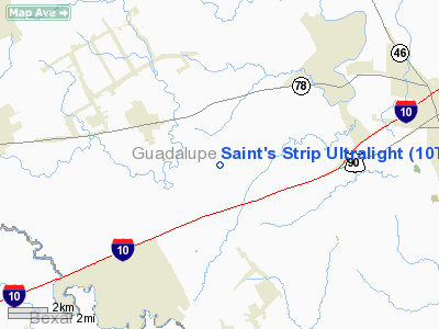
Saint's Strip Ultralight Airport |
Location & QuickFacts
| FAA Information Effective: | 2008-09-25 |
| Airport Identifier: | 10TS |
| Airport Status: | Operational |
| Longitude/Latitude: | 098-06-11.0280W/29-33-08.8270N
-98.103063/29.552452 (Estimated) |
| Elevation: | 980 ft / 298.70 m (Estimated) |
| Land: | 7 acres |
| From nearest city: | 2 nautical miles SE of Marion, TX |
| Location: | Guadalupe County, TX |
| Magnetic Variation: | 07E (1986) |
Owner & Manager
| Ownership: | Privately owned |
| Owner: | Avis P St Romain |
| Address: | Rt 4 Box 412
Seguin, TX 78155-9423 |
| Phone number: | 210-914-3530 |
| Manager: | Avis P St Romain |
| Address: | Rt 4 Box 412
Seguin, TX 78155-9423 |
| Phone number: | 210-914-3530 |
Airport Operations and Facilities
| Airport Use: | Private |
| Wind indicator: | Yes |
| Segmented Circle: | No |
| Control Tower: | No |
| Sectional chart: | San Antonio |
| Region: | ASW - Southwest |
| Boundary ARTCC: | ZHU - Houston |
| Tie-in FSS: | SJT - San Angelo |
| FSS Toll Free: | 1-800-WX-BRIEF |
Runway Information
Runway 16/34
| Dimension: | 900 x 60 ft / 274.3 x 18.3 m |
| Surface: | TURF, |
| |
Runway 16 |
Runway 34 |
| Traffic Pattern: | Right | Left |
| Obstruction: | | 5 ft fence, 50.0 ft from runway |
|
Radio Navigation Aids
| ID |
Type |
Name |
Ch |
Freq |
Var |
Dist |
| CVB | NDB | Castroville | | 338.00 | 08E | 41.0 nm |
| PEZ | NDB | Pleasanton | | 275.00 | 07E | 42.0 nm |
| DHK | TACAN | Randolph | 036X | | 09E | 8.7 nm |
| KSY | TACAN | Kelly | 057X | | 07E | 26.8 nm |
| SSF | VOR | Stinson | | 108.40 | 09E | 25.1 nm |
| RND | VORTAC | Randolph | 70X | 112.30 | 09E | 9.7 nm |
| SAT | VORTAC | San Antonio | 115X | 116.80 | 08E | 19.5 nm |
| SAT | VOT | San Antonio Intl | | 110.40 | | 19.2 nm |
Remarks
- LAND ON 160 DEG HEADING - TKOF ON 340 DEG HEADING.
Images and information placed above are from
http://www.airport-data.com/airport/10TS/
We thank them for the data!
| General Info
|
| Country |
United States
|
| State |
TEXAS
|
| FAA ID |
10TS
|
| Latitude |
29-33-08.827N
|
| Longitude |
098-06-11.028W
|
| Elevation |
980 feet
|
| Near City |
MARION
|
We don't guarantee the information is fresh and accurate. The data may
be wrong or outdated.
For more up-to-date information please refer to other sources.
|
|


