 |
|
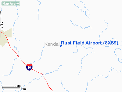
Location & QuickFacts
| FAA Information Effective: | 2008-09-25 |
| Airport Identifier: | 8XS9 |
| Airport Status: | Operational |
| Longitude/Latitude: | 098-47-26.1080W/29-57-25.7720N
-98.790586/29.957159 (Estimated) |
| Elevation: | 1331 ft / 405.69 m (Estimated) |
| Land: | 103 acres |
| From nearest city: | 1 nautical miles NE of Waring, TX |
| Location: | Kendall County, TX |
| Magnetic Variation: | 08E (1980) |
Owner & Manager
| Ownership: | Privately owned |
| Owner: | Elton Rust |
| Address: | Box 458
Waring, TX 78074 |
| Phone number: | 512-995-3924 |
| Manager: | Elton Rust |
| Address: | Box 458
Waring, TX 78074 |
| Phone number: | 512-824-7511 |
Airport Operations and Facilities
| Airport Use: | Private |
| Wind indicator: | Yes |
| Segmented Circle: | No |
| Control Tower: | No |
| Landing fee charge: | No |
| Sectional chart: | San Antonio |
| Region: | ASW - Southwest |
| Boundary ARTCC: | ZHU - Houston |
| Tie-in FSS: | SJT - San Angelo |
| FSS on Airport: | No |
| FSS Toll Free: | 1-800-WX-BRIEF |
Runway Information
Runway 17/35
| Dimension: | 2331 x 28 ft / 710.5 x 8.5 m |
| Surface: | ASPH, |
| |
Runway 17 |
Runway 35 |
| Traffic Pattern: | Left | Left |
|
Radio Navigation Aids
| ID |
Type |
Name |
Ch |
Freq |
Var |
Dist |
| ER | NDB | Shein | | 263.00 | 08E | 11.7 nm |
| CVB | NDB | Castroville | | 338.00 | 08E | 36.9 nm |
| HMA | NDB | Hondo | | 329.00 | 08E | 40.3 nm |
| MFS | NDB | Horseshoe Bay Resort | | 403.00 | 07E | 40.8 nm |
| HHH | NDB | Devine | | 359.00 | 07E | 49.8 nm |
| KSY | TACAN | Kelly | 057X | | 07E | 35.7 nm |
| DHK | TACAN | Randolph | 036X | | 09E | 37.2 nm |
| SSF | VOR | Stinson | | 108.40 | 09E | 45.8 nm |
| HDO | VOR/DME | Hondo | 31X | 109.40 | 08E | 41.8 nm |
| STV | VORTAC | Stonewall | 085X | 113.80 | 08E | 15.6 nm |
| CSI | VORTAC | Center Point | 122X | 117.50 | 08E | 22.2 nm |
| SAT | VORTAC | San Antonio | 115X | 116.80 | 08E | 25.5 nm |
| RND | VORTAC | Randolph | 70X | 112.30 | 09E | 37.3 nm |
| SAT | VOT | San Antonio Intl | | 110.40 | | 30.5 nm |
Images and information placed above are from
http://www.airport-data.com/airport/8XS9/
We thank them for the data!
| General Info
|
| Country |
United States
|
| State |
TEXAS
|
| FAA ID |
8XS9
|
| Latitude |
29-57-25.772N
|
| Longitude |
098-47-26.108W
|
| Elevation |
1331 feet
|
| Near City |
WARING
|
We don't guarantee the information is fresh and accurate. The data may
be wrong or outdated.
For more up-to-date information please refer to other sources.
|
|


