 |
|
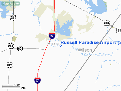
Location & QuickFacts
| FAA Information Effective: | 2008-09-25 |
| Airport Identifier: | 2TX1 |
| Airport Status: | Operational |
| Longitude/Latitude: | 098-23-01.0480W/29-13-30.8660N
-98.383624/29.225241 (Estimated) |
| Elevation: | 535 ft / 163.07 m (Estimated) |
| Land: | 0 acres |
| From nearest city: | 4 nautical miles SW of Elmendorf, TX |
| Location: | Bexar County, TX |
| Magnetic Variation: | 07E (1985) |
Owner & Manager
| Ownership: | Privately owned |
| Owner: | Allen Russell |
| Address: | Rt 1/box 108a
Elmendorf, TX 78112 |
| Phone number: | 512-621-2236 |
| Manager: | Allen Russell |
| Address: | Rt 1/box 108a
Elmendorf, TX 78112 |
| Phone number: | 512-621-2236 |
Airport Operations and Facilities
| Airport Use: | Private |
| Wind indicator: | Yes |
| Segmented Circle: | No |
| Control Tower: | No |
| Sectional chart: | San Antonio |
| Region: | ASW - Southwest |
| Boundary ARTCC: | ZHU - Houston |
| Tie-in FSS: | SJT - San Angelo |
| FSS Toll Free: | 1-800-WX-BRIEF |
Runway Information
Runway 12/30
| Dimension: | 2588 x 80 ft / 788.8 x 24.4 m |
| Surface: | TURF, |
| |
Runway 12 |
Runway 30 |
| Traffic Pattern: | Left | Left |
| Obstruction: | 5 ft fence, 40.0 ft from runway | 5 ft fence, 40.0 ft from runway |
|
Radio Navigation Aids
| ID |
Type |
Name |
Ch |
Freq |
Var |
Dist |
| PEZ | NDB | Pleasanton | | 275.00 | 07E | 17.7 nm |
| CVB | NDB | Castroville | | 338.00 | 08E | 25.5 nm |
| HHH | NDB | Devine | | 359.00 | 07E | 29.6 nm |
| HMA | NDB | Hondo | | 329.00 | 08E | 42.3 nm |
| KSY | TACAN | Kelly | 057X | | 07E | 14.4 nm |
| DHK | TACAN | Randolph | 036X | | 09E | 19.7 nm |
| SSF | VOR | Stinson | | 108.40 | 09E | 3.7 nm |
| HDO | VOR/DME | Hondo | 31X | 109.40 | 08E | 42.3 nm |
| RND | VORTAC | Randolph | 70X | 112.30 | 09E | 18.4 nm |
| SAT | VORTAC | San Antonio | 115X | 116.80 | 08E | 25.5 nm |
| THX | VORTAC | Three Rivers | 051X | 111.40 | 08E | 45.0 nm |
| SAT | VOT | San Antonio Intl | | 110.40 | | 19.1 nm |
Remarks
- PRVDD LANDING THRS ARE LCTD TO PRVD 20:1 APCH SLOPE CLEARANCE OVER ANY OBSTRUCTIONS APCH AREAS.
Images and information placed above are from
http://www.airport-data.com/airport/2TX1/
We thank them for the data!
| General Info
|
| Country |
United States
|
| State |
TEXAS
|
| FAA ID |
2TX1
|
| Latitude |
29-13-30.866N
|
| Longitude |
098-23-01.048W
|
| Elevation |
535 feet
|
| Near City |
ELMENDORF
|
We don't guarantee the information is fresh and accurate. The data may
be wrong or outdated.
For more up-to-date information please refer to other sources.
|
|


