 |
|
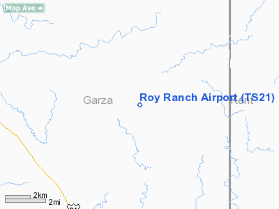
Location & QuickFacts
| FAA Information Effective: | 2008-09-25 |
| Airport Identifier: | TS21 |
| Airport Status: | Operational |
| Longitude/Latitude: | 101-06-53.4000W/33-05-05.4000N
-101.114833/33.084833 (Estimated) |
| Elevation: | 2366 ft / 721.16 m (Estimated) |
| Land: | 0 acres |
| From nearest city: | 5 nautical miles E of Justiceburg, TX |
| Location: | Garza County, TX |
| Magnetic Variation: | () |
Owner & Manager
| Ownership: | Privately owned |
| Owner: | John C. Cox |
| Address: | 1717 Main St Ste 2800
Dallas, TX 75201 |
| Phone number: | 214-939-5599 |
| Manager: | John C. Cox |
| Address: | 1717 Main St Ste 2800
Dallas, TX 75201 |
| Phone number: | 214-939-5599 |
Airport Operations and Facilities
| Airport Use: | Private |
| Control Tower: | No |
| Sectional chart: | Dallas-ft Worth |
| Region: | ASW - Southwest |
| Boundary ARTCC: | ZFW - Fort Worth |
| Tie-in FSS: | FTW - Fort Worth |
| FSS Phone: | 817-541-3474 |
| FSS Toll Free: | 1-800-WX-BRIEF |
Runway Information
Runway 08/26
| Dimension: | 3000 x 75 ft / 914.4 x 22.9 m |
| Surface: | TURF, |
| |
Runway 08 |
Runway 26 |
| Traffic Pattern: | Left | Left |
|
Runway 17/35
| Dimension: | 3000 x 75 ft / 914.4 x 22.9 m |
| Surface: | TURF, |
| |
Runway 17 |
Runway 35 |
| Traffic Pattern: | Left | Left |
| Obstruction: | 20 ft trees, 150.0 ft from runway | |
|
Radio Navigation Aids
| ID |
Type |
Name |
Ch |
Freq |
Var |
Dist |
| SDR | NDB | Snyder | | 359.00 | 08E | 24.6 nm |
| CZX | NDB | Crosbyton | | 332.00 | 09E | 33.0 nm |
| LSA | NDB | Lamesa | | 338.00 | 09E | 44.9 nm |
| SWW | NDB | Sweetwater | | 275.00 | 08E | 49.8 nm |
| BGS | VORTAC | Big Spring | 090X | 114.30 | 11E | 46.0 nm |
Remarks
- 30 FT PLINE 300 FT NORTH OF THE ARPT.
- PRVDD VFR OPNS, CLEAR 20:1 APCHS, CLEAR20:1 TO THE TREES AND PLINE NORTHOF THE ARPT OR TOP THE TREES AND MARK THE PLINE WITH ORANGE BALLS.
Images and information placed above are from
http://www.airport-data.com/airport/TS21/
We thank them for the data!
| General Info
|
| Country |
United States
|
| State |
TEXAS
|
| FAA ID |
TS21
|
| Latitude |
29-38-04.832N
|
| Longitude |
095-16-20.768W
|
| Elevation |
48 feet
|
| Near City |
HOUSTON
|
We don't guarantee the information is fresh and accurate. The data may
be wrong or outdated.
For more up-to-date information please refer to other sources.
|
|


