 |
|
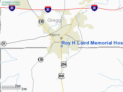
Roy H Laird Memorial Hospital Heliport |
Location & QuickFacts
| FAA Information Effective: | 2008-09-25 |
| Airport Identifier: | 96TA |
| Airport Status: | Operational |
| Longitude/Latitude: | 094-52-05.7740W/32-22-23.5440N
-94.868271/32.373207 (Estimated) |
| Elevation: | 343 ft / 104.55 m (Estimated) |
| Land: | 0 acres |
| From nearest city: | 0 nautical miles N of Kilgore, TX |
| Location: | Gregg County, TX |
| Magnetic Variation: | 05E (1990) |
Owner & Manager
| Ownership: | Privately owned |
| Owner: | Roy H Laird Hospital |
| Address: | 1612 S. Henderson Blvd
Kilgore, TX 75662 |
| Phone number: | 903-984-3505 |
| Manager: | Roderick Lagrone/mark Tippitt |
| Address: | 1612 S. Henderson Blvd
Kilgore, TX 75662 |
| Phone number: | 903-984-3505 |
Airport Operations and Facilities
| Airport Use: | Private
MEDICAL USE ONLY. |
| Wind indicator: | Yes |
| Segmented Circle: | No |
| Control Tower: | No |
| Lighting Schedule: | PHONE REQ
FOR PERIMETER LGTS CALL 903-984-3305. |
| Sectional chart: | Memphis |
| Region: | ASW - Southwest |
| Boundary ARTCC: | ZFW - Fort Worth |
| Tie-in FSS: | FTW - Fort Worth |
| FSS on Airport: | No |
| FSS Phone: | 817-541-3474 |
| FSS Toll Free: | 1-800-WX-BRIEF |
Runway Information
Helipad H1
| Dimension: | 20 x 20 ft / 6.1 x 6.1 m |
| Surface: | CONC, |
| |
Runway H1 |
Runway |
| Traffic Pattern: | Left | Left |
|
Radio Navigation Aids
| ID |
Type |
Name |
Ch |
Freq |
Var |
Dist |
| HNO | NDB | Henderson | | 371.00 | 06E | 11.1 nm |
| ABG | NDB | Ambassador | | 404.00 | 07E | 17.8 nm |
| TY | NDB | Tyler | | 320.00 | 06E | 30.6 nm |
| RPF | NDB | Carthage | | 332.00 | 04E | 31.3 nm |
| LST | NDB | Lone Star | | 305.00 | 05E | 33.9 nm |
| JSO | NDB | Cherokee County | | 263.00 | 05E | 35.0 nm |
| GXD | NDB | Nacogdoches | | 391.00 | 05E | 44.3 nm |
| CZJ | NDB | Amason | | 341.00 | 04E | 48.8 nm |
| TYR | VOR/DME | Tyler | 089X | 114.20 | 06E | 27.2 nm |
| FZT | VOR/DME | Frankston | 051X | 111.40 | 06E | 38.2 nm |
| UIM | VOR/DME | Quitman | 087X | 114.00 | 08E | 39.6 nm |
| GGG | VORTAC | Gregg County | 070X | 112.30 | 07E | 6.4 nm |
Remarks
- SEE AIRSPACE LTR DATED JULY 23, 1990.
Images and information placed above are from
http://www.airport-data.com/airport/96TA/
We thank them for the data!
| General Info
|
| Country |
United States
|
| State |
TEXAS
|
| FAA ID |
96TA
|
| Latitude |
32-22-23.544N
|
| Longitude |
094-52-05.774W
|
| Elevation |
343 feet
|
| Near City |
KILGORE
|
We don't guarantee the information is fresh and accurate. The data may
be wrong or outdated.
For more up-to-date information please refer to other sources.
|
|


