 |
|
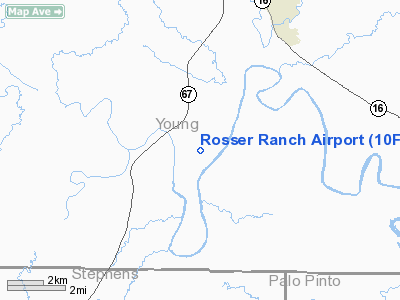
Location & QuickFacts
| FAA Information Effective: | 2008-09-25 |
| Airport Identifier: | 10F |
| Airport Status: | Operational |
| Longitude/Latitude: | 098-37-31.2110W/33-00-55.4220N
-98.625336/33.015395 (Estimated) |
| Elevation: | 1112 ft / 338.94 m (Estimated) |
| Land: | 52 acres |
| From nearest city: | 6 nautical miles SW of Graham, TX |
| Location: | Young County, TX |
| Magnetic Variation: | 07E (1985) |
Owner & Manager
| Ownership: | Privately owned |
| Owner: | Richard M Rosser |
| Address: | 4913 Wynne Lane
Graham, TX 76046 |
| Phone number: | 940-549-7258 |
| Manager: | R M Rosser |
| Address: | 4913 Wynne Lane
Graham, TX 76046 |
| Phone number: | 940-549-7258
EMERGENCY PHONE: 940-521-4943 |
Airport Operations and Facilities
| Airport Use: | Open to public |
| Wind indicator: | Yes |
| Segmented Circle: | No |
| Control Tower: | No |
| Landing fee charge: | No |
| Sectional chart: | Dallas-ft Worth |
| Region: | ASW - Southwest |
| Boundary ARTCC: | ZFW - Fort Worth |
| Tie-in FSS: | FTW - Fort Worth |
| FSS on Airport: | No |
| FSS Phone: | 817-541-3474 |
| FSS Toll Free: | 1-800-WX-BRIEF |
| NOTAMs Facility: | FTW (NOTAM-d service avaliable) |
Airport Communications
Airport Services
| Airframe Repair: | NONE |
| Power Plant Repair: | NONE |
Runway Information
Runway 18/36
| Dimension: | 3600 x 200 ft / 1097.3 x 61.0 m |
| Surface: | TURF, Good Condition |
| |
Runway 18 |
Runway 36 |
| Traffic Pattern: | Left | Left |
| Obstruction: | 10 ft road, 100 ft right of centerline | 5 ft fence, 0.0 ft from runway, 100L/ ft right of centerline |
|
Radio Navigation Aids
| ID |
Type |
Name |
Ch |
Freq |
Var |
Dist |
| GHX | NDB | Graham | | 371.00 | 07E | 11.1 nm |
| GZV | NDB | Brazos River | | 280.00 | 07E | 11.4 nm |
| BKD | NDB | Breckenridge | | 245.00 | 07E | 21.0 nm |
| ONY | NDB | Olney | | 272.00 | 07E | 22.4 nm |
| MWL | NDB | Mineral Wells | | 266.00 | 06E | 31.8 nm |
| OIP | NDB | Old Rip | | 410.00 | 07E | 38.2 nm |
| SKB | NDB | Scotland | | 344.00 | 08E | 47.1 nm |
| MQP | VORTAC | Millsap | 124X | 117.70 | 09E | 36.2 nm |
Images and information placed above are from
http://www.airport-data.com/airport/10F/
We thank them for the data!
| General Info
|
| Country |
United States
|
| State |
TEXAS
|
| FAA ID |
10F
|
| Latitude |
33-00-55.422N
|
| Longitude |
098-37-31.211W
|
| Elevation |
1112 feet
|
| Near City |
GRAHAM
|
We don't guarantee the information is fresh and accurate. The data may
be wrong or outdated.
For more up-to-date information please refer to other sources.
|
|


