 |
|
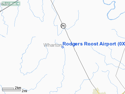
Location & QuickFacts
| FAA Information Effective: | 2008-09-25 |
| Airport Identifier: | 0XS1 |
| Airport Status: | Operational |
| Longitude/Latitude: | 096-20-59.0000W/29-17-16.0000N
-96.349722/29.287778 (Estimated) |
| Elevation: | 129 ft / 39.32 m (Estimated) |
| Land: | 0 acres |
| From nearest city: | 7 nautical miles N of El Campo, TX |
| Location: | Wharton County, TX |
| Magnetic Variation: | 06E (1990) |
Owner & Manager
| Ownership: | Privately owned |
| Owner: | Bob Rodgers |
| Address: | 2605 Meadow Lane
El Campo, TX 77437 |
| Phone number: | 409-543-6953 |
| Manager: | Bob Rodgers |
| Address: | 2605 Meadow Lane
El Campo, TX 77437 |
| Phone number: | 409-543-6953 |
Airport Operations and Facilities
| Airport Use: | Private |
| Segmented Circle: | No |
| Control Tower: | No |
| Sectional chart: | Houston |
| Region: | ASW - Southwest |
| Boundary ARTCC: | ZHU - Houston |
| Tie-in FSS: | CXO - Montgomery County |
| FSS on Airport: | No |
| FSS Toll Free: | 1-800-WX-BRIEF |
Runway Information
Runway 14/32
| Dimension: | 1500 x 60 ft / 457.2 x 18.3 m |
| Surface: | TURF, |
| |
Runway 14 |
Runway 32 |
| Traffic Pattern: | Left | Left |
|
Radio Navigation Aids
| ID |
Type |
Name |
Ch |
Freq |
Var |
Dist |
| ARM | NDB | Wharton | | 245.00 | 06E | 10.6 nm |
| BYY | NDB | Bay City | | 344.00 | 06E | 32.0 nm |
| OKT | NDB | Yoakum | | 350.00 | 06E | 41.4 nm |
| SGR | NDB | Hull | | 388.00 | 05E | 41.8 nm |
| PKV | NDB | Port Lavaca | | 515.00 | 05E | 42.1 nm |
| LYD | NDB | Lakeside | | 249.00 | 05E | 47.4 nm |
| SYG | NDB | Sandy Point | | 402.00 | 05E | 47.9 nm |
| ELA | VOR/DME | Eagle Lake | 111X | 116.40 | 08E | 22.6 nm |
| VCT | VOR/DME | Victoria | 027X | 109.00 | 06E | 40.4 nm |
| PSX | VORTAC | Palacios | 120X | 117.30 | 08E | 31.5 nm |
| IDU | VORTAC | Industry | 039X | 110.20 | 08E | 41.7 nm |
Remarks
- PRVDD ALL TFC OPNS CONDUCTED ON WEST SIDE OF ARPT.
Images and information placed above are from
http://www.airport-data.com/airport/0XS1/
We thank them for the data!
| General Info
|
| Country |
United States
|
| State |
TEXAS
|
| FAA ID |
0XS1
|
| Latitude |
29-17-16.000N
|
| Longitude |
096-20-59.000W
|
| Elevation |
129 feet
|
| Near City |
EL CAMPO
|
We don't guarantee the information is fresh and accurate. The data may
be wrong or outdated.
For more up-to-date information please refer to other sources.
|
|


