 |
|
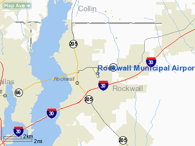
Location & QuickFacts
| FAA Information Effective: | 2008-09-25 |
| Airport Identifier: | F46 |
| Airport Status: | Operational |
| Longitude/Latitude: | 096-26-07.7480W/32-55-50.1400N
-96.435486/32.930594 (Estimated) |
| Elevation: | 574 ft / 174.96 m (Surveyed) |
| Land: | 50 acres |
| From nearest city: | 2 nautical miles E of Rockwall, TX |
| Location: | Rockwall County, TX |
| Magnetic Variation: | 05E (2000) |
Owner & Manager
| Ownership: | Publicly owned |
| Owner: | City Of Rockwall
RICK CROWLEY, DIR. OF PUBLIC WORKS. |
| Address: | 205 W Rusk
Rockwall, TX 75087 |
| Phone number: | 972-771-7700 |
| Manager: | Eddie Walkowicz
ROCKWALL AVIATION, INC. |
| Address: | 1701 Airport Rd.
Rockwall, TX 75087 |
| Phone number: | 972-771-0151
EMERGENCY PHONE: 972-771-7177 (POLICE). |
Airport Operations and Facilities
| Airport Use: | Open to public |
| Wind indicator: | Yes |
| Segmented Circle: | Yes |
| Control Tower: | No |
| Lighting Schedule: | DUSK-DAWN
ACTVT LIRL RY 17/35 - CTAF. |
| Beacon Color: | Clear-Green (lighted land airport) |
| Landing fee charge: | No |
| Sectional chart: | Dallas-ft Worth |
| Region: | ASW - Southwest |
| Boundary ARTCC: | ZFW - Fort Worth |
| Tie-in FSS: | FTW - Fort Worth |
| FSS on Airport: | No |
| FSS Phone: | 817-541-3474 |
| FSS Toll Free: | 1-800-WX-BRIEF |
| NOTAMs Facility: | FTW (NOTAM-d service avaliable) |
| Federal Agreements: | NY1 |
Airport Communications
| CTAF: | 122.800 |
| Unicom: | 122.800 |
Airport Services
| Fuel available: | 100LLA |
| Airframe Repair: | MAJOR |
| Power Plant Repair: | MAJOR |
| Bottled Oxygen: | NONE |
| Bulk Oxygen: | NONE |
Runway Information
Runway 17/35
| Dimension: | 3373 x 45 ft / 1028.1 x 13.7 m |
| Surface: | ASPH, Good Condition |
| Weight Limit: | Single wheel: 12000 lbs. |
| Edge Lights: | Low
NUMEROUS RY LIGHTS MISSING OR INOPERATIVE; DSPLCD THLD LIGHTS INOPERATIVE; RY 36 END OF RY LIGHTS BROKEN OR INOPERATIVE. |
| |
Runway 17 |
Runway 35 |
| Longitude: | 096-26-10.3120W | 096-26-05.1170W |
| Latitude: | 32-56-06.6820N | 32-55-33.6040N |
| Elevation: | 559.00 ft | 563.00 ft |
| Alignment: | 127 | 127 |
| Traffic Pattern: | Left | Right |
| Markings: | Non-precision instrument, Good Condition | Non-precision instrument, Good Condition |
| Displaced threshold: | 470.00 ft | 289.00 ft |
| Obstruction: | 30 ft twr, 400.0 ft from runway, 125 ft left of centerline, 6:1 slope to clear
APCH RATIO 29:1; +30 FT TOWER 870 FT FM DSPLCD THLD 125 FT L EXTDD CNTRLN. | 33 ft tree, 770.0 ft from runway, 17:1 slope to clear
APCH RATIO 2:1; +15' HGR 55' SOUTH OF DSPLCD THR 211' R.
ROAD AT 10' ON EXTDD CNTRLN. |
|
Radio Navigation Aids
| ID |
Type |
Name |
Ch |
Freq |
Var |
Dist |
| PQF | NDB | Mesquite | | 248.00 | 06E | 8.7 nm |
| MII | NDB | Caddo Mills | | 316.00 | 06E | 11.5 nm |
| AVZ | NDB | Travis | | 260.00 | 06E | 13.9 nm |
| JUG | NDB | Jecca | | 388.00 | 06E | 16.5 nm |
| SYW | NDB | Cash | | 428.00 | 05E | 18.8 nm |
| LNC | NDB | Lancaster | | 239.00 | 06E | 25.7 nm |
| RBD | NDB | Redbird | | 287.00 | 06E | 26.8 nm |
| XQH | NDB | Cedar Hill | | 353.00 | 08E | 34.1 nm |
| HJM | NDB | Rayburn | | 415.00 | 06E | 43.1 nm |
| MJF | TACAN | Arvilla | 033X | | 05E | 20.5 nm |
| CVE | VOR/DME | Cowboy | 109X | 116.20 | 06E | 23.8 nm |
| TTT | VOR/DME | Maverick | 078X | 113.10 | 06E | 30.8 nm |
| SLR | VOR/DME | Sulphur Springs | 027X | 109.00 | 08E | 47.8 nm |
| FUZ | VORTAC | Ranger | 104X | 115.70 | 06E | 37.6 nm |
| BYP | VORTAC | Bonham | 093X | 114.60 | 06E | 37.9 nm |
| CQY | VORTAC | Cedar Creek | 095X | 114.80 | 06E | 46.1 nm |
| DAL | VOT | Dallas Love Field | | 113.30 | | 21.6 nm |
| FTW | VOT | Fort Worth Meacham | | 108.20 | | 47.1 nm |
Remarks
- NO LINE OF SIGHT.
- RY 17 50 FT DROP OFF AT APCH END OF PAVEMENT; STEEP DOWN SLOPE ALL SIDES OF DISPLACEMENT.
- RY 17/35 HAS 6-18 INCH SHARP DROP-OFFS BOTH SIDES OF RY.
- PARALLEL TWY AND RAMP HAS 6-18 INCH DROP-OFF ALONG SIDES.
Images and information placed above are from
http://www.airport-data.com/airport/F46/
We thank them for the data!
| General Info
|
| Country |
United States
|
| State |
TEXAS
|
| FAA ID |
F46
|
| Latitude |
32-55-50.140N
|
| Longitude |
096-26-07.748W
|
| Elevation |
574 feet
|
| Near City |
ROCKWALL
|
We don't guarantee the information is fresh and accurate. The data may
be wrong or outdated.
For more up-to-date information please refer to other sources.
|
|


