 |
|
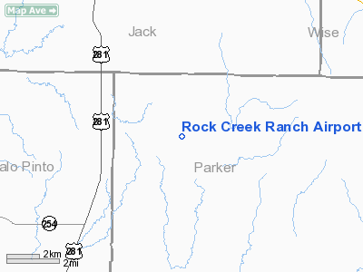
Location & QuickFacts
| FAA Information Effective: | 2008-09-25 |
| Airport Identifier: | TS47 |
| Airport Status: | Operational |
| Longitude/Latitude: | 098-00-41.1460W/32-58-06.4380N
-98.011429/32.968455 (Estimated) |
| Elevation: | 1130 ft / 344.42 m (Surveyed) |
| Land: | 0 acres |
| From nearest city: | 1 nautical miles NE of Whitt, TX |
| Location: | Parker County, TX |
| Magnetic Variation: | 07E (1990) |
Owner & Manager
| Ownership: | Privately owned |
| Owner: | Tom & Michelle Butt |
| Address: | 5100 Fry Lane
Colleyville, TX 76034 |
| Phone number: | 817-281-0374 |
| Manager: | Tom & Michelle Butt |
| Address: | 5100 Fry Lane
Colleyville, TX 76034 |
| Phone number: | 817-281-0374 |
Airport Operations and Facilities
| Airport Use: | Private |
| Segmented Circle: | No |
| Control Tower: | No |
| Sectional chart: | Dallas-ft Worth |
| Region: | ASW - Southwest |
| Boundary ARTCC: | ZFW - Fort Worth |
| Tie-in FSS: | FTW - Fort Worth |
| FSS on Airport: | No |
| FSS Phone: | 817-541-3474 |
| FSS Toll Free: | 1-800-WX-BRIEF |
Runway Information
Runway 14/32
| Dimension: | 1800 x 120 ft / 548.6 x 36.6 m |
| Surface: | TURF, |
| |
Runway 14 |
Runway 32 |
| Traffic Pattern: | Left | Right |
|
Radio Navigation Aids
| ID |
Type |
Name |
Ch |
Freq |
Var |
Dist |
| MWL | NDB | Mineral Wells | | 266.00 | 06E | 11.3 nm |
| GZV | NDB | Brazos River | | 280.00 | 07E | 20.3 nm |
| GHX | NDB | Graham | | 371.00 | 07E | 27.2 nm |
| GMZ | NDB | Grindstone Mountain | | 356.00 | 07E | 40.1 nm |
| BKD | NDB | Breckenridge | | 245.00 | 07E | 46.4 nm |
| ONY | NDB | Olney | | 272.00 | 07E | 46.6 nm |
| NFW | TACAN | Nas Jrb Fort Worth | 024X | | 07E | 31.2 nm |
| TTT | VOR/DME | Maverick | 078X | 113.10 | 06E | 49.4 nm |
| MQP | VORTAC | Millsap | 124X | 117.70 | 09E | 14.6 nm |
| UKW | VORTAC | Bowie | 071X | 112.40 | 06E | 35.4 nm |
| FUZ | VORTAC | Ranger | 104X | 115.70 | 06E | 42.2 nm |
| JEN | VORTAC | Glen Rose | 097X | 115.00 | 06E | 49.1 nm |
| FTW | VOT | Fort Worth Meacham | | 108.20 | | 34.2 nm |
Remarks
- PRVDD ALL OPNS ARE CONDUCTED EAST OF RY 14/32.
Images and information placed above are from
http://www.airport-data.com/airport/TS47/
We thank them for the data!
| General Info
|
| Country |
United States
|
| State |
TEXAS
|
| FAA ID |
TS47
|
| Latitude |
32-58-06.438N
|
| Longitude |
098-00-41.146W
|
| Elevation |
1130 feet
|
| Near City |
WHITT
|
We don't guarantee the information is fresh and accurate. The data may
be wrong or outdated.
For more up-to-date information please refer to other sources.
|
|


