 |
|
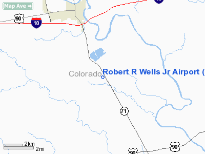
Robert R Wells Jr Airport |
Location & QuickFacts
| FAA Information Effective: | 2008-09-25 |
| Airport Identifier: | 66R |
| Airport Status: | Operational |
| Longitude/Latitude: | 096-30-56.8930W/29-38-27.8510N
-96.515804/29.641070 (Estimated) |
| Elevation: | 242 ft / 73.76 m (Estimated) |
| Land: | 42 acres |
| From nearest city: | 3 nautical miles S of Columbus, TX |
| Location: | Colorado County, TX |
| Magnetic Variation: | 06E (1985) |
Owner & Manager
| Ownership: | Publicly owned |
| Owner: | Colorado County |
| Address: | Po Box 236
Columbus, TX 78934 |
| Phone number: | 979-732-2604
COUNTY JUDGE OFFICE. |
| Manager: | Bob Cowart |
| Address: | Po Box 236
Columbus, TX 78934 |
| Phone number: | 979-732-9500
AMGR OFFICE. |
Airport Operations and Facilities
| Airport Use: | Open to public |
| Wind indicator: | Yes |
| Segmented Circle: | Yes |
| Control Tower: | No |
| Lighting Schedule: | DUSK-DAWN
ACTVT MIRL RY 15/33 - CTAF. |
| Beacon Color: | Clear-Green (lighted land airport)
ROTG BCN OTS INDEFLY. |
| Landing fee charge: | No |
| Sectional chart: | Houston |
| Region: | ASW - Southwest |
| Boundary ARTCC: | ZHU - Houston |
| Tie-in FSS: | CXO - Montgomery County |
| FSS on Airport: | No |
| FSS Toll Free: | 1-800-WX-BRIEF
FOR FP FILING CALL CXO FSS 1-800-833-5602 |
| NOTAMs Facility: | CXO (NOTAM-d service avaliable) |
Airport Communications
Airport Services
| Fuel available: | 100LLA
FOR FUEL AFT HRS CALL 409-732-6249 OR PAGE 1-800-604-9075. |
| Airframe Repair: | NONE |
| Power Plant Repair: | NONE |
| Bottled Oxygen: | NONE |
Runway Information
Runway 15/33
| Dimension: | 3800 x 60 ft / 1158.2 x 18.3 m |
| Surface: | ASPH, Fair Condition |
| Weight Limit: | Single wheel: 12500 lbs. |
| Edge Lights: | Medium |
| |
Runway 15 |
Runway 33 |
| Traffic Pattern: | Left | Left |
| Markings: | Basic, Good Condition
RY 15/33 NBRS & DSPLCD THLD BARS FADED. | Basic, Good Condition |
| Displaced threshold: | 305.00 ft | 177.00 ft |
| VASI: | 2-light PAPI on left side | 2-light PAPI on left side |
| Runway End Identifier: | Yes | Yes
REIL OTS INDEFLY. |
| Obstruction: | 6 ft fence, 200.0 ft from runway, 49 ft right of centerline
APCH RATIO 0:1 FM DSPLCD THLD BASED ON +4 FT FENCE 85 FT R OF CNTRLN AT DSPLCD THLD.
+4 FT FENCE 180 FT FM THLD; PAVED RD 200 FT FM THLD; +4 FT FENCE 85 FT RIGHT OF CNTRLN PARALLEL TO CNTRLN; +13 FT BRUSH 170 FT FM THLD ON CNTRLN. | 12 ft brush, 200.0 ft from runway, 87 ft left of centerline
APCH RATIO 0:1 FM DSPLCD THLD BASED ON +4 FT FENCE 85 FT L OF CNTRLN AT DSPLCD THLD.
+4 FT FENCE 110 FT FM THLD; +4 FT FENCE 85 FT L OF CNTRLN PARALLEL TO CNTRLN; +25 FT TREE 100 FT L & 140 FT FM THLD; +8 FT BRUSH 100 FT L & 110 FT FM THLD. |
|
Radio Navigation Aids
| ID |
Type |
Name |
Ch |
Freq |
Var |
Dist |
| ARM | NDB | Wharton | | 245.00 | 06E | 30.0 nm |
| BNH | NDB | Brenham | | 362.00 | 06E | 35.7 nm |
| OKT | NDB | Yoakum | | 350.00 | 06E | 38.1 nm |
| GYB | NDB | Lee County | | 385.00 | 07E | 39.9 nm |
| SGR | NDB | Hull | | 388.00 | 05E | 44.9 nm |
| LYD | NDB | Lakeside | | 249.00 | 05E | 45.0 nm |
| EYQ | NDB | Weiser | | 286.00 | 06E | 48.9 nm |
| ELA | VOR/DME | Eagle Lake | 111X | 116.40 | 08E | 10.5 nm |
| IDU | VORTAC | Industry | 039X | 110.20 | 08E | 19.1 nm |
| TNV | VORTAC | Navasota | 106X | 115.90 | 08E | 45.6 nm |
Remarks
- PRVDD RWY IS LCTD TO PRVD 20:1 SLOPE OVER ELECTRIC LINE OR IF THE LINE IS PLACED UNDERGROUND.
Images and information placed above are from
http://www.airport-data.com/airport/66R/
We thank them for the data!
| General Info
|
| Country |
United States
|
| State |
TEXAS
|
| FAA ID |
66R
|
| Latitude |
29-38-27.851N
|
| Longitude |
096-30-56.893W
|
| Elevation |
242 feet
|
| Near City |
COLUMBUS
|
We don't guarantee the information is fresh and accurate. The data may
be wrong or outdated.
For more up-to-date information please refer to other sources.
|
|


