 |
|
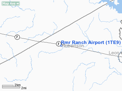
Location & QuickFacts
| FAA Information Effective: | 2008-09-25 |
| Airport Identifier: | 1TE9 |
| Airport Status: | Operational |
| Longitude/Latitude: | 096-26-21.0000W/31-16-19.0000N
-96.439167/31.271944 (Estimated) |
| Elevation: | 420 ft / 128.02 m (Estimated) |
| Land: | 110 acres |
| From nearest city: | 15 nautical miles NN of Franklin, TX |
| Location: | Robertson County, TX |
| Magnetic Variation: | 05E (2000) |
Owner & Manager
| Ownership: | Privately owned |
| Owner: | Ray Field |
| Address: | 13140 State Hwy 7, Po Box 692
Franklin, TX 77856 |
| Phone number: | 979-828-3927 |
| Manager: | Ray Field |
| Address: | Po Box 692
Franklin, TX 77856 |
| Phone number: | 979-828-3927 |
Airport Operations and Facilities
| Airport Use: | Private |
| Segmented Circle: | No |
| Control Tower: | No |
| Sectional chart: | Houston |
| Region: | ASW - Southwest |
| Boundary ARTCC: | ZHU - Houston |
| Tie-in FSS: | CXO - Montgomery County |
| FSS Toll Free: | 1-800-WX-BRIEF |
Runway Information
Runway 15/33
| Dimension: | 1800 x 150 ft / 548.6 x 45.7 m |
| Surface: | TURF, |
| |
Runway 15 |
Runway 33 |
| Traffic Pattern: | Left | Left |
| Displaced threshold: | 200.00 ft | 0.00 ft |
|
Radio Navigation Aids
| ID |
Type |
Name |
Ch |
Freq |
Var |
Dist |
| LXY | NDB | Mexia | | 329.00 | 07E | 22.4 nm |
| ROB | NDB | Robinson | | 400.00 | 07E | 35.2 nm |
| PYF | NDB | Pyramid | | 418.00 | 06E | 37.6 nm |
| CRS | NDB | Corsicana | | 396.00 | 06E | 45.5 nm |
| CGQ | NDB | Powell | | 344.00 | 06E | 47.6 nm |
| PSN | NDB | Palestine | | 375.00 | 04E | 48.6 nm |
| GNL | VOR/DME | Groesbeck | 025X | 108.80 | 05E | 19.4 nm |
| LOA | VORTAC | Leona | 045X | 110.80 | 08E | 25.8 nm |
| CLL | VORTAC | College Station | 080X | 113.30 | 08E | 40.1 nm |
| ACT | VORTAC | Waco | 100X | 115.30 | 09E | 48.6 nm |
Images and information placed above are from
http://www.airport-data.com/airport/1TE9/
We thank them for the data!
|
|


