 |
|
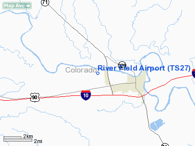
Location & QuickFacts
| FAA Information Effective: | 2008-09-25 |
| Airport Identifier: | TS27 |
| Airport Status: | Operational |
| Longitude/Latitude: | 096-35-28.8800W/29-42-58.3000N
-96.591356/29.716194 (Estimated) |
| Elevation: | 220 ft / 67.06 m (Estimated) |
| Land: | 7 acres |
| From nearest city: | 2 nautical miles E of Columbus, TX |
| Location: | Colorado County, TX |
| Magnetic Variation: | 05E (2000) |
Owner & Manager
| Ownership: | Privately owned |
| Owner: | Rob Parrish |
| Address: | Po Box 130507
Houston, TX 77219 |
| Phone number: | 713-862-1664 |
| Manager: | Rob Parrish |
| Address: | Po Box 130507
Houston, TX 77219 |
| Phone number: | 713-862-1664 |
Airport Operations and Facilities
| Airport Use: | Private |
| Wind indicator: | Yes |
| Segmented Circle: | No |
| Control Tower: | No |
| Sectional chart: | Houston |
| Region: | ASW - Southwest |
| Boundary ARTCC: | ZHU - Houston |
| Tie-in FSS: | CXO - Montgomery County |
| FSS Toll Free: | 1-800-WX-BRIEF |
Runway Information
Runway 17/35
| Dimension: | 2800 x 100 ft / 853.4 x 30.5 m |
| Surface: | TURF, |
| |
Runway 17 |
Runway 35 |
| Traffic Pattern: | Right | Left |
|
Radio Navigation Aids
| ID |
Type |
Name |
Ch |
Freq |
Var |
Dist |
| BNH | NDB | Brenham | | 362.00 | 06E | 32.5 nm |
| GYB | NDB | Lee County | | 385.00 | 07E | 33.9 nm |
| ARM | NDB | Wharton | | 245.00 | 06E | 36.0 nm |
| OKT | NDB | Yoakum | | 350.00 | 06E | 37.5 nm |
| LYD | NDB | Lakeside | | 249.00 | 05E | 48.1 nm |
| SGR | NDB | Hull | | 388.00 | 05E | 49.1 nm |
| ELA | VOR/DME | Eagle Lake | 111X | 116.40 | 08E | 14.7 nm |
| IDU | VORTAC | Industry | 039X | 110.20 | 08E | 14.5 nm |
| TNV | VORTAC | Navasota | 106X | 115.90 | 08E | 44.2 nm |
Remarks
- LIVESTOCK & WILDLIFE MAY BE ON RY.
- (CONTACT TITLE) WORK PHONE 713-441-3800, CELL PHONE 713-545-6900.
- PRVDD A CLEAR 20:1 APCH SLOPE TO BOTH ENDS OF RY.
Images and information placed above are from
http://www.airport-data.com/airport/TS27/
We thank them for the data!
| General Info
|
| Country |
United States
|
| State |
TEXAS
|
| FAA ID |
TS27
|
| Latitude |
29-42-58.300N
|
| Longitude |
096-35-28.880W
|
| Elevation |
220 feet
|
| Near City |
COLUMBUS
|
We don't guarantee the information is fresh and accurate. The data may
be wrong or outdated.
For more up-to-date information please refer to other sources.
|
|


