 |
|
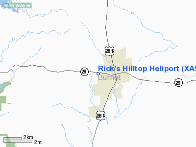
Location & QuickFacts
| FAA Information Effective: | 2008-09-25 |
| Airport Identifier: | XA94 |
| Airport Status: | Operational |
| Longitude/Latitude: | 098-14-55.5000W/30-45-31.1400N
-98.248750/30.758650 (Estimated) |
| Elevation: | 1300 ft / 396.24 m (Estimated) |
| Land: | 0 acres |
| From nearest city: | 1 nautical miles W of Burnet, TX |
| Location: | Burnet County, TX |
| Magnetic Variation: | () |
Owner & Manager
| Ownership: | Privately owned |
| Owner: | Rick Neely |
| Address: | Po Box 850
Burnet, TX 78611 |
| Phone number: | 512-756-7996 |
| Manager: | Rick Neely |
| Address: | Po Box 850
Burnet, TX 78611 |
| Phone number: | 512-756-7996 |
Airport Operations and Facilities
| Airport Use: | Private |
| Wind indicator: | Yes |
| Control Tower: | No |
| Lighting Schedule: | PHONE REQ
FOR PERIMETER LGTS CALL 512-756-7996. |
| Sectional chart: | San Antonio |
| Region: | ASW - Southwest |
| Boundary ARTCC: | ZHU - Houston |
| Tie-in FSS: | SJT - San Angelo |
| FSS Toll Free: | 1-800-WX-BRIEF |
Runway Information
Helipad H1
| Dimension: | 30 x 30 ft / 9.1 x 9.1 m |
| Surface: | CONC, Good Condition |
| |
Runway H1 |
Runway |
| Traffic Pattern: | Left | Left |
|
Radio Navigation Aids
| ID |
Type |
Name |
Ch |
Freq |
Var |
Dist |
| BMQ | NDB | Burnet | | 341.00 | 07E | 1.3 nm |
| MFS | NDB | Horseshoe Bay Resort | | 403.00 | 07E | 15.2 nm |
| GUO | NDB | Georgetown | | 332.00 | 06E | 29.7 nm |
| GR | NDB | Starn | | 323.00 | 07E | 31.1 nm |
| IL | NDB | Iresh | | 278.00 | 07E | 32.1 nm |
| HLR | NDB | Hood | | 347.00 | 07E | 35.5 nm |
| GRK | VOR/DME | Gray | 055X | 111.80 | 07E | 27.8 nm |
| LZZ | VORTAC | Lampasas | 072X | 112.50 | 08E | 26.2 nm |
| LLO | VORTAC | Llano | 019X | 108.20 | 08E | 27.9 nm |
| STV | VORTAC | Stonewall | 085X | 113.80 | 08E | 40.8 nm |
| CWK | VORTAC | Centex | 075X | 112.80 | 06E | 43.7 nm |
Images and information placed above are from
http://www.airport-data.com/airport/XA94/
We thank them for the data!
|
|


