 |
|
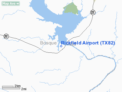
Location & QuickFacts
| FAA Information Effective: | 2008-09-25 |
| Airport Identifier: | TX82 |
| Airport Status: | Operational |
| Longitude/Latitude: | 097-22-51.4000W/31-51-49.0000N
-97.380944/31.863611 (Estimated) |
| Elevation: | 620 ft / 188.98 m (Estimated) |
| Land: | 4 acres |
| From nearest city: | 4 nautical miles E of Laguna Park, TX |
| Location: | Bosque County, TX |
| Magnetic Variation: | 06E (1995) |
Owner & Manager
| Ownership: | Privately owned |
| Owner: | Rick Fields |
| Address: | Po Box 5234
Laguna Park, TX 76644 |
| Phone number: | 254-622-2555 |
| Manager: | Rick Fields |
| Address: | Po Box 5234
Laguna Park, TX 76644 |
| Phone number: | 254-622-2555 |
Airport Operations and Facilities
| Airport Use: | Private |
| Wind indicator: | Yes |
| Segmented Circle: | No |
| Control Tower: | No |
| Sectional chart: | San Antonio |
| Region: | ASW - Southwest |
| Boundary ARTCC: | ZFW - Fort Worth |
| Tie-in FSS: | FTW - Fort Worth |
| FSS on Airport: | No |
| FSS Phone: | 817-541-3474 |
| FSS Toll Free: | 1-800-WX-BRIEF |
Runway Information
Runway 15/33
| Dimension: | 1972 x 150 ft / 601.1 x 45.7 m |
| Surface: | TURF, |
| |
Runway 15 |
Runway 33 |
| Longitude: | 097-22-57.6000W | 097-22-47.0000W |
| Latitude: | 31-51-57.5000N | 31-51-41.2000N |
| Traffic Pattern: | Left | Left |
| Obstruction: | 15 ft pline, 75.0 ft from runway | 15 ft trees, 75.0 ft from runway |
|
Radio Navigation Aids
| ID |
Type |
Name |
Ch |
Freq |
Var |
Dist |
| ROB | NDB | Robinson | | 400.00 | 07E | 26.9 nm |
| MNZ | NDB | Hamilton | | 251.00 | 07E | 41.8 nm |
| LXY | NDB | Mexia | | 329.00 | 07E | 46.4 nm |
| HLR | NDB | Hood | | 347.00 | 07E | 47.3 nm |
| XQH | NDB | Cedar Hill | | 353.00 | 08E | 48.3 nm |
| GR | NDB | Starn | | 323.00 | 07E | 49.0 nm |
| TPL | VOR/DME | Temple | 041X | 110.40 | 09E | 39.4 nm |
| GNL | VOR/DME | Groesbeck | 025X | 108.80 | 05E | 45.8 nm |
| ACT | VORTAC | Waco | 100X | 115.30 | 09E | 13.4 nm |
| JEN | VORTAC | Glen Rose | 097X | 115.00 | 06E | 30.9 nm |
Remarks
- TURF RY OVERLAYS SOLID LIMESTONE.
Images and information placed above are from
http://www.airport-data.com/airport/TX82/
We thank them for the data!
| General Info
|
| Country |
United States
|
| State |
TEXAS
|
| FAA ID |
TX82
|
| Latitude |
31-51-49.000N
|
| Longitude |
097-22-51.400W
|
| Elevation |
680 feet
|
| Near City |
LAGUNA PARK
|
We don't guarantee the information is fresh and accurate. The data may
be wrong or outdated.
For more up-to-date information please refer to other sources.
|
|


