 |
|
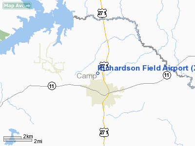
Location & QuickFacts
| FAA Information Effective: | 2008-09-25 |
| Airport Identifier: | XA23 |
| Airport Status: | Operational |
| Longitude/Latitude: | 094-58-20.1000W/33-01-04.0000N
-94.972250/33.017778 (Estimated) |
| Elevation: | 400 ft / 121.92 m (Estimated) |
| Land: | 40 acres |
| From nearest city: | 1 nautical miles N of Pittsburg, TX |
| Location: | Camp County, TX |
| Magnetic Variation: | () |
Owner & Manager
| Ownership: | Privately owned |
| Owner: | Larry J. Richardson |
| Address: | 623 Cr 2106
Pittsburg, TX 75686 |
| Phone number: | 903-856-2751 |
| Manager: | Larry J. Richardson |
| Address: | 623 Cr 2106
Pittsburg, TX 75686 |
| Phone number: | 903-856-2751 |
Airport Operations and Facilities
| Airport Use: | Private |
| Wind indicator: | Yes |
| Control Tower: | No |
| Sectional chart: | Memphis |
| Region: | ASW - Southwest |
| Boundary ARTCC: | ZFW - Fort Worth |
| Tie-in FSS: | FTW - Fort Worth |
| FSS Phone: | 817-541-3474 |
| FSS Toll Free: | 1-800-WX-BRIEF |
Runway Information
Runway 17/35
| Dimension: | 2800 x 60 ft / 853.4 x 18.3 m |
| Surface: | TURF, |
| |
Runway 17 |
Runway 35 |
| Traffic Pattern: | Left | Left |
| Obstruction: | 40 ft pline, 1000.0 ft from runway | 15 ft road, 100.0 ft from runway |
|
Radio Navigation Aids
| ID |
Type |
Name |
Ch |
Freq |
Var |
Dist |
| LST | NDB | Lone Star | | 305.00 | 05E | 12.7 nm |
| ABG | NDB | Ambassador | | 404.00 | 07E | 26.9 nm |
| ATA | NDB | Atlanta | | 347.00 | 04E | 39.7 nm |
| TY | NDB | Tyler | | 320.00 | 06E | 44.1 nm |
| VIV | NDB | Vivian | | 284.00 | 06E | 49.5 nm |
| UIM | VOR/DME | Quitman | 087X | 114.00 | 08E | 21.5 nm |
| SLR | VOR/DME | Sulphur Springs | 027X | 109.00 | 08E | 30.7 nm |
| PRX | VOR/DME | Paris | 083X | 113.60 | 07E | 39.6 nm |
| TYR | VOR/DME | Tyler | 089X | 114.20 | 06E | 45.4 nm |
| GGG | VORTAC | Gregg County | 070X | 112.30 | 07E | 37.7 nm |
Images and information placed above are from
http://www.airport-data.com/airport/XA23/
We thank them for the data!
|
|


