 |
|
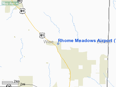
Location & QuickFacts
| FAA Information Effective: | 2008-09-25 |
| Airport Identifier: | T76 |
| Airport Status: | Operational |
| Longitude/Latitude: | 097-29-46.0860W/33-08-57.4320N
-97.496135/33.149287 (Estimated) |
| Elevation: | 900 ft / 274.32 m (Estimated) |
| Land: | 238 acres |
| From nearest city: | 6 nautical miles N of Rhome, TX |
| Location: | Wise County, TX |
| Magnetic Variation: | 07E (1984) |
Owner & Manager
| Ownership: | Privately owned |
| Owner: | Rhome Meadows Management Group |
| Address: | P.o. Box 560, North Richland Hills
Rhome, TX 76078 |
| Phone number: | 972-231-4930 |
| Manager: | Bill Leavelle |
| Address: | 922 Sandlewood, North Richland Hills
Richardson, TX 75080 |
| Phone number: | 922-231-4930 |
Airport Operations and Facilities
| Airport Use: | Open to public |
| Wind indicator: | Yes |
| Segmented Circle: | No |
| Control Tower: | No |
| Sectional chart: | Dallas-ft Worth |
| Region: | ASW - Southwest |
| Traffic Pattern Alt: | 800 ft |
| Boundary ARTCC: | ZFW - Fort Worth |
| Tie-in FSS: | FTW - Fort Worth |
| FSS Phone: | 817-541-3474 |
| FSS Toll Free: | 1-800-WX-BRIEF |
| NOTAMs Facility: | FTW (NOTAM-d service avaliable) |
Airport Communications
Airport Services
Runway Information
Runway 13/31
| Dimension: | 3700 x 60 ft / 1127.8 x 18.3 m |
| Surface: | TURF, Good Condition
RY 31 END SOFT WHEN WET. |
| |
Runway 13 |
Runway 31 |
| Traffic Pattern: | Right | Right |
| Displaced threshold: | 260.00 ft
DSPLCD THLD MARKED WITH WHITE TIRES. | 0.00 ft |
| Obstruction: | 4 ft fence, 51 ft right of centerline
APCH SLOPE 0:1 BASED ON DSPLCD THLD; 4 FT FENCE 51 FT R AT DSPLCD THLD. | 4 ft fence, 0.0 ft from runway, 65 ft left of centerline |
|
Radio Navigation Aids
| ID |
Type |
Name |
Ch |
Freq |
Var |
Dist |
| GMZ | NDB | Grindstone Mountain | | 356.00 | 07E | 30.7 nm |
| MWL | NDB | Mineral Wells | | 266.00 | 06E | 35.8 nm |
| GLE | NDB | Gainesville | | 330.00 | 06E | 37.3 nm |
| RBD | NDB | Redbird | | 287.00 | 06E | 42.4 nm |
| XQH | NDB | Cedar Hill | | 353.00 | 08E | 42.6 nm |
| GZV | NDB | Brazos River | | 280.00 | 07E | 47.7 nm |
| NFW | TACAN | Nas Jrb Fort Worth | 024X | | 07E | 22.9 nm |
| TTT | VOR/DME | Maverick | 078X | 113.10 | 06E | 28.5 nm |
| CVE | VOR/DME | Cowboy | 109X | 116.20 | 06E | 33.7 nm |
| FUZ | VORTAC | Ranger | 104X | 115.70 | 06E | 22.3 nm |
| UKW | VORTAC | Bowie | 071X | 112.40 | 06E | 28.4 nm |
| MQP | VORTAC | Millsap | 124X | 117.70 | 09E | 35.9 nm |
| FTW | VOT | Fort Worth Meacham | | 108.20 | | 21.1 nm |
| DAL | VOT | Dallas Love Field | | 113.30 | | 37.2 nm |
Remarks
- UNLGTD 120 FT CELL TOWER 2000 FT WEST OF RY.
- ALL ACFT MONITOR CTAF DUE TO THE CLOSE PROXIMITY TO HERITAGE CREEK AIRSTRIP.
- PRVDD TFC PATTERN IS LIMITED TO THE SOUTHWEST SIDE OF THE ARPT.
Images and information placed above are from
http://www.airport-data.com/airport/T76/
We thank them for the data!
|
|


