 |
|
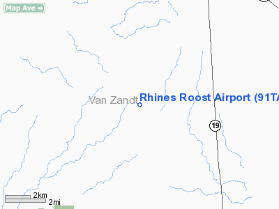
Location & QuickFacts
| FAA Information Effective: | 2008-09-25 |
| Airport Identifier: | 91TA |
| Airport Status: | Operational |
| Longitude/Latitude: | 095-55-07.8800W/32-26-45.5000N
-95.918856/32.445972 (Estimated) |
| Elevation: | 540 ft / 164.59 m (Estimated) |
| Land: | 25 acres |
| From nearest city: | 7 nautical miles S of Canton, TX |
| Location: | Van Zandt County, TX |
| Magnetic Variation: | () |
Owner & Manager
| Ownership: | Privately owned |
| Owner: | Thomas & Gayle Rhines |
| Address: | 2911 Falcon Way
Midlothian, TX 76065 |
| Phone number: | 972-723-6884 |
| Manager: | Thomas Rhines |
| Address: | 2911 Falcon Way
Midlothian, TX 76065 |
| Phone number: | 972-723-6884 |
Airport Operations and Facilities
| Airport Use: | Private |
| Wind indicator: | Yes |
| Segmented Circle: | No |
| Control Tower: | No |
| Sectional chart: | Dallas-ft Worth |
| Region: | ASW - Southwest |
| Boundary ARTCC: | ZFW - Fort Worth |
| Tie-in FSS: | FTW - Fort Worth |
| FSS Phone: | 817-541-3474 |
| FSS Toll Free: | 1-800-WX-BRIEF |
Runway Information
Runway 18/36
| Dimension: | 2230 x 60 ft / 679.7 x 18.3 m |
| Surface: | TURF, Good Condition |
| |
Runway 18 |
Runway 36 |
| Traffic Pattern: | Left | Left |
|
Radio Navigation Aids
| ID |
Type |
Name |
Ch |
Freq |
Var |
Dist |
| AHX | NDB | Athens | | 269.00 | 06E | 17.8 nm |
| TY | NDB | Tyler | | 320.00 | 06E | 22.9 nm |
| CSZ | NDB | Crossroads | | 215.00 | 08E | 23.1 nm |
| AVZ | NDB | Travis | | 260.00 | 06E | 25.2 nm |
| LIQ | NDB | Lochridge Ranch | | 335.00 | 09E | 26.2 nm |
| SYW | NDB | Cash | | 428.00 | 05E | 33.1 nm |
| JUG | NDB | Jecca | | 388.00 | 06E | 33.8 nm |
| CGQ | NDB | Powell | | 344.00 | 06E | 34.6 nm |
| CRS | NDB | Corsicana | | 396.00 | 06E | 34.9 nm |
| PYF | NDB | Pyramid | | 418.00 | 06E | 37.8 nm |
| PQF | NDB | Mesquite | | 248.00 | 06E | 37.8 nm |
| MII | NDB | Caddo Mills | | 316.00 | 06E | 39.4 nm |
| LNC | NDB | Lancaster | | 239.00 | 06E | 41.5 nm |
| PSN | NDB | Palestine | | 375.00 | 04E | 41.5 nm |
| ABG | NDB | Ambassador | | 404.00 | 07E | 41.7 nm |
| JSO | NDB | Cherokee County | | 263.00 | 05E | 49.8 nm |
| MJF | TACAN | Arvilla | 033X | | 05E | 38.0 nm |
| TYR | VOR/DME | Tyler | 089X | 114.20 | 06E | 26.7 nm |
| FZT | VOR/DME | Frankston | 051X | 111.40 | 06E | 29.8 nm |
| UIM | VOR/DME | Quitman | 087X | 114.00 | 08E | 38.2 nm |
| SLR | VOR/DME | Sulphur Springs | 027X | 109.00 | 08E | 49.1 nm |
| CQY | VORTAC | Cedar Creek | 095X | 114.80 | 06E | 21.8 nm |
Images and information placed above are from
http://www.airport-data.com/airport/91TA/
We thank them for the data!
|
|


