 |
|
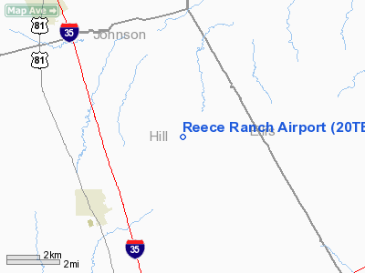
Location & QuickFacts
| FAA Information Effective: | 2008-09-25 |
| Airport Identifier: | 20TE |
| Airport Status: | Operational |
| Longitude/Latitude: | 097-05-21.0170W/32-11-45.5360N
-97.089171/32.195982 (Estimated) |
| Elevation: | 880 ft / 268.22 m (Estimated) |
| Land: | 10 acres |
| From nearest city: | 4 nautical miles NE of Itasca, TX |
| Location: | Hill County, TX |
| Magnetic Variation: | 07E (1985) |
Owner & Manager
| Ownership: | Privately owned |
| Owner: | Paul Reece |
| Address: | Route 1
Itasca, TX 76055 |
| Phone number: | 817-687-2260 |
| Manager: | Paul Reece |
| Address: | Route 1
Itasca, TX 76055 |
| Phone number: | 817-687-2260 |
Airport Operations and Facilities
| Airport Use: | Private |
| Wind indicator: | No |
| Segmented Circle: | No |
| Control Tower: | No |
| Landing fee charge: | No |
| Sectional chart: | Dallas-ft Worth |
| Region: | ASW - Southwest |
| Boundary ARTCC: | ZFW - Fort Worth |
| Tie-in FSS: | FTW - Fort Worth |
| FSS on Airport: | No |
| FSS Phone: | 817-541-3474 |
| FSS Toll Free: | 1-800-WX-BRIEF |
Airport Services
| Airframe Repair: | NONE |
| Power Plant Repair: | NONE |
| Bottled Oxygen: | NONE |
| Bulk Oxygen: | NONE |
Runway Information
Runway 17/35
| Dimension: | 2200 x 100 ft / 670.6 x 30.5 m |
| Surface: | TURF, |
| |
Runway 17 |
Runway 35 |
| Traffic Pattern: | Left | Left |
|
Radio Navigation Aids
| ID |
Type |
Name |
Ch |
Freq |
Var |
Dist |
| XQH | NDB | Cedar Hill | | 353.00 | 08E | 24.4 nm |
| LNC | NDB | Lancaster | | 239.00 | 06E | 29.6 nm |
| RBD | NDB | Redbird | | 287.00 | 06E | 31.0 nm |
| CGQ | NDB | Powell | | 344.00 | 06E | 34.6 nm |
| CRS | NDB | Corsicana | | 396.00 | 06E | 36.7 nm |
| JUG | NDB | Jecca | | 388.00 | 06E | 40.0 nm |
| ROB | NDB | Robinson | | 400.00 | 07E | 41.6 nm |
| LXY | NDB | Mexia | | 329.00 | 07E | 44.6 nm |
| PQF | NDB | Mesquite | | 248.00 | 06E | 46.5 nm |
| PYF | NDB | Pyramid | | 418.00 | 06E | 49.7 nm |
| NFW | TACAN | Nas Jrb Fort Worth | 024X | | 07E | 38.9 nm |
| TTT | VOR/DME | Maverick | 078X | 113.10 | 06E | 40.5 nm |
| CVE | VOR/DME | Cowboy | 109X | 116.20 | 06E | 42.8 nm |
| GNL | VOR/DME | Groesbeck | 025X | 108.80 | 05E | 46.1 nm |
| ACT | VORTAC | Waco | 100X | 115.30 | 09E | 33.4 nm |
| JEN | VORTAC | Glen Rose | 097X | 115.00 | 06E | 40.2 nm |
| FUZ | VORTAC | Ranger | 104X | 115.70 | 06E | 41.9 nm |
| CQY | VORTAC | Cedar Creek | 095X | 114.80 | 06E | 44.3 nm |
| FTW | VOT | Fort Worth Meacham | | 108.20 | | 39.8 nm |
| DAL | VOT | Dallas Love Field | | 113.30 | | 40.9 nm |
Remarks
- PRESUMED TO PRE DATE THE ACT.
Images and information placed above are from
http://www.airport-data.com/airport/20TE/
We thank them for the data!
| General Info
|
| Country |
United States
|
| State |
TEXAS
|
| FAA ID |
20TE
|
| Latitude |
32-11-45.536N
|
| Longitude |
097-05-21.017W
|
| Elevation |
880 feet
|
| Near City |
ITASCA
|
We don't guarantee the information is fresh and accurate. The data may
be wrong or outdated.
For more up-to-date information please refer to other sources.
|
|


