 |
|
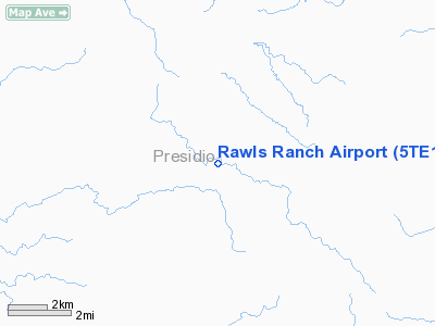
Location & QuickFacts
| FAA Information Effective: | 2008-09-25 |
| Airport Identifier: | 5TE1 |
| Airport Status: | Operational |
| Longitude/Latitude: | 103-57-01.6980W/29-39-00.6530N
-103.950472/29.650181 (Estimated) |
| Elevation: | 4520 ft / 1377.70 m (Estimated) |
| Land: | 0 acres |
| From nearest city: | 39 nautical miles S of Marfa, TX |
| Location: | Presidio County, TX |
| Magnetic Variation: | 09E (1985) |
Owner & Manager
| Ownership: | Privately owned |
| Owner: | Johnny Stubbs |
| Address: | Box 515
Clint, TX 79836 |
| Phone number: | 915-851-3354 |
| Manager: | Johnny Stubbs |
| Address: | Box 515
Clint, TX 79836 |
| Phone number: | 915-851-3354 |
Airport Operations and Facilities
| Airport Use: | Private |
| Wind indicator: | Yes |
| Segmented Circle: | No |
| Control Tower: | No |
| Landing fee charge: | No |
| Sectional chart: | El Paso |
| Region: | ASW - Southwest |
| Boundary ARTCC: | ZAB - Albuquerque |
| Tie-in FSS: | SJT - San Angelo |
| FSS on Airport: | No |
| FSS Toll Free: | 1-800-WX-BRIEF |
Airport Services
| Airframe Repair: | NONE |
| Power Plant Repair: | NONE |
Runway Information
Runway 03/21
| Dimension: | 1800 x 75 ft / 548.6 x 22.9 m |
| Surface: | DIRT, |
| |
Runway 03 |
Runway 21 |
| Traffic Pattern: | Left | Left |
|
Runway 08/26
| Dimension: | 3722 x 75 ft / 1134.5 x 22.9 m |
| Surface: | DIRT, |
| |
Runway 08 |
Runway 26 |
| Traffic Pattern: | Left | Left |
|
Runway 12/30
| Dimension: | 2400 x 75 ft / 731.5 x 22.9 m |
| Surface: | DIRT, |
| |
Runway 12 |
Runway 30 |
| Traffic Pattern: | Left | Left |
|
Runway 17/35
| Dimension: | 1600 x 75 ft / 487.7 x 22.9 m |
| Surface: | DIRT, |
| |
Runway 17 |
Runway 35 |
| Traffic Pattern: | Left | Left |
|
Radio Navigation Aids
| ID |
Type |
Name |
Ch |
Freq |
Var |
Dist |
| MRF | VOR/DME | Marfa | 106X | 115.90 | 11E | 39.0 nm |
Images and information placed above are from
http://www.airport-data.com/airport/5TE1/
We thank them for the data!
| General Info
|
| Country |
United States
|
| State |
TEXAS
|
| FAA ID |
5TE1
|
| Latitude |
29-39-00.653N
|
| Longitude |
103-57-01.698W
|
| Elevation |
4520 feet
|
| Near City |
MARFA
|
We don't guarantee the information is fresh and accurate. The data may
be wrong or outdated.
For more up-to-date information please refer to other sources.
|
|


