 |
|
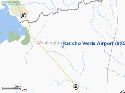
Location & QuickFacts
| FAA Information Effective: | 2008-09-25 |
| Airport Identifier: | 9XS9 |
| Airport Status: | Operational |
| Longitude/Latitude: | 096-26-51.0000W/30-17-00.0000N
-96.447500/30.283333 (Estimated) |
| Elevation: | 275 ft / 83.82 m (Estimated) |
| Land: | 35 acres |
| From nearest city: | 7 nautical miles N of Brenham, TX |
| Location: | Washington County, TX |
| Magnetic Variation: | () |
Owner & Manager
| Ownership: | Privately owned |
| Owner: | Bryan Green |
| Address: | 8221 Cedar Hill Rd
Brenham, TX 77833 |
| Phone number: | 936-443-7813 |
| Manager: | Bryan Green |
| Address: | 8221 Cedar Hill Rd
Brenham, TX 77833 |
| Phone number: | 936-443-7813 |
Airport Operations and Facilities
| Airport Use: | Private |
| Wind indicator: | Yes |
| Control Tower: | No |
| Sectional chart: | Houston |
| Region: | ASW - Southwest |
| Boundary ARTCC: | ZHU - Houston |
| Tie-in FSS: | CXO - Montgomery County |
| FSS Toll Free: | 1-800-WX-BRIEF |
Runway Information
Runway 15/33
| Dimension: | 1800 x 75 ft / 548.6 x 22.9 m |
| Surface: | TURF, |
| |
Runway 15 |
Runway 33 |
| Traffic Pattern: | Left | Right |
|
Radio Navigation Aids
| ID |
Type |
Name |
Ch |
Freq |
Var |
Dist |
| BNH | NDB | Brenham | | 362.00 | 06E | 5.3 nm |
| GYB | NDB | Lee County | | 385.00 | 07E | 28.4 nm |
| DWH | NDB | David Hooks | | 521.00 | 05E | 46.8 nm |
| EYQ | NDB | Weiser | | 286.00 | 06E | 46.9 nm |
| LYD | NDB | Lakeside | | 249.00 | 05E | 48.9 nm |
| ELA | VOR/DME | Eagle Lake | 111X | 116.40 | 08E | 37.9 nm |
| CLL | VORTAC | College Station | 080X | 113.30 | 08E | 19.4 nm |
| TNV | VORTAC | Navasota | 106X | 115.90 | 08E | 20.2 nm |
| IDU | VORTAC | Industry | 039X | 110.20 | 08E | 20.6 nm |
Remarks
- PRVDD ALL TFC PATTERNS BE LIMITED TO THE NE SIDE OF THE ARPT.
Images and information placed above are from
http://www.airport-data.com/airport/9XS9/
We thank them for the data!
| General Info
|
| Country |
United States
|
| State |
TEXAS
|
| FAA ID |
9XS9
|
| Latitude |
29-54-45.810N
|
| Longitude |
095-49-35.823W
|
| Elevation |
165 feet
|
| Near City |
KATY
|
We don't guarantee the information is fresh and accurate. The data may
be wrong or outdated.
For more up-to-date information please refer to other sources.
|
|


